
Introductory Remarks
This year's Incheon-to-Busan walk ended on November 11, 2023—also known in South Korea as the frivolous Pepero Day, named after the Pepero snack (a chocolate-dipped pretzel stick) that probably started off in Japan as Pocky. In digits, November 11 is 11/11, which looks like four Pepero sticks in a row, so some clever marketer decided 11/11 ought to be Pepero Day. And here we are. Not the most auspicious day on which to end a walk, but it fit the timing of my 29-day schedule. This walk featured a shortcut or two, thus minimizing the amount I had to camp, so I walked for only 23 days and enjoyed 6 much-needed rest days. Other stats:
Total distance including the distance walked on rest days: 630 km (391.5 mi.)
Weight before the walk started: 119.5 kg (263.5 lbs.)
Weight at the end of the walk: 111 kg (244.7 lbs.)—an 8.5-kilo loss (18.7 lbs.)
Resting heart rate before walk: 80-90 beats per min (bpm)
Resting heart rate after walk: 68 bpm
Average distance walked: 26 km
Total steps walked: 1,034,490
Belt-hole progress: 3-4 belt holes (i.e., 3-4-inch loss around the waist)
Not too bad for a geezer, and a walk of about a million steps at roughly 26K a day seems to be standard for the Four Rivers path. I admit I walked slowly, never getting above 4 kph with an 11-13-kilo pack on my back (the weight variation was due to the fluctuating amount of water I had with me). The difference of a kilo or two proved to be irrelevant; it didn't affect my walking rate much or at all, and it certainly didn't affect the subjective experience of trekking. I had to laugh at my Korean coworker the other day, when he switched some food out from a glass container to a plastic container because the glass container was "too heavy" to carry all the way home. Size has no meaning; it matters not! (In truth, it does sort of matter. In some cases.)
As I documented earlier, I arrived at the Nakdong River Estuary Barrage on the walk's final day and didn't stick around long. There was the whole affair of being unable to get a room at the Westin (I ended up staying at my usual motel, the Gwangjang, right next to Busan Station); add to that the awkwardness of my buddy Neil's schedule: he lives in Masan, and it turned out there were only four buses scattered throughout the day going to and from Masan. Neil and I were supposed to meet for dinner at 5:30 at the Westin, but because of the bus schedule, Neil had little choice but to arrive in Busan at 2:30 p.m. We met a bit early, did dinner, and I had to abandon Neil to go back to my motel. That was around 7:30 p.m., but Neil's bus back to Masan wasn't until 9:30 p.m. I have now resolved never to invite Neil to Busan again; the awkwardness and inconvenience for him are just too much. I ended up feeling very guilty about the whole thing despite the fact that dinner itself was pretty good, with Neil—who is much thinner—somehow matching me blow-for-blow at the buffet. (Neil had recently run a half-marathon. That should give you an idea of how healthy he is.)
The KTX ride back to Seoul the following day ended up being a scrunched and uncomfortable affair; there is apparently no longer any comfortable way to get back to Seoul. I've tried the express-bus thing, and that led to a long ride (traffic jams) and a very achy ass. And while the KTX might be comfortable if you end up with a decent seat, I was placed right in the middle of the car, where the forward-facing and backward-facing seats meet, i.e., I had to look in someone's face for most of the ride back, as well as keep my feet uncomfortably pulled back to avoid touching that person's feet. Someone a few seats over proved to be a deep and noisy sleeper: his snores reverberated throughout the inside of my car.
 |
| me at Busan station, minutes before the arrival of the KTX that would take me back to Seoul |
But I made it back home, got a cab at Seoul Station, and stumbled into my apartment while it was still morning, knowing I had to go to work the following day. That joke about needing a vacation after my vacation was echoing in my head; I'd just been out in the elements for a month—not exactly away from civilization, but still exposed to the weather and walking long distances all day, every day.
Doing the walk three weeks later than usual did affect me in one important way: the sun, when it shone, wasn't nearly as harsh, and I didn't end up with the usual nasty sunburns and blisters and peeling that I've experienced before. I still ended up with my "suntan gloves," though:
 |
| right hand |
 |
| left hand, looking leathery |
The freckles betray my Irish heritage (the linked pic is apparently by generative AI), and my forearms are lighter because I wore my toshi/토시 (sleevelets) to protect my skin from more burns. Of course, my head without the bandanna on looked ridiculous:
 |
| pasty forehead |
...and that's how I've been ever since. I don't wear my bandanna in the office, so I have no choice but to show off my glowing forehead. Everyone's too polite to say anything, but I'm sure people have noticed that I'm a little uglier than usual.
My Poor Feet
You might want to avoid this next part of my bodily self-assessment: it's time to talk about the damage done to my feet, especially my toes. 2021, the year of my stroke, might be the only year when I crossed the country and didn't experience much foot damage, and that's because I had lost so much weight during and after my hospital stay—28 kg (61.7 lbs.) in three months. Weight loss is the key, the answer to many of my foot problems. Light, skinny people don't generally have to contend with the amount of damage that I contend with, and that's because we're all subject to the same 1 g of gravitational force. I've regained weight since 2021, which doesn't help. I hereby take back my "size has no meaning" remark above.
 |
| right big toe, 11/12/23 |
 |
| right big toe, 11/12/23—lots of callus |
About the above shot: you may recall, if you followed my main blog, that I spent nearly a year healing up from a diabetic ulcer on my right big toe. Just before this walk, I accidentally reopened that ulcer ever so slightly while clipping at calluses, causing a small but annoying leak that lasted partway through the walk. It re-healed a few weeks in, and what you see above is the aftermath. I've begun soaking my left foot in Epsom-salt baths, and I really should do the same with the right foot. A campaign of soak-and-scrub ought to get rid of most of the nasty-looking, callused skin, not to mention the discoloration that makes things look worse than they are.
 |
| right sole, 11/12/23: blistering/bruising near "ball" of the pinky toe, source of major ache |
The above bruising was the source of a lot of my pain while walking. My tendency to supinate probably didn't help matters. There are apparently orthotics for people who supinate; I'll have to look into those. I dealt with the pain partly via NSAIDs (ibuprofen in my case), and partly by just walking through the pain, which is not as irrational as it sounds.
 |
| right foot, 11/12/23: blister that crept down the side of the foot |
The blood blister on my left foot (see below) was painless but weird-looking. It was as if I'd somehow gotten a black gambling chip fused to the bottom of my foot. It started life as a liquid-filled blister, but the fluid somehow dried up, and the remaining contents congealed, leaving the bruise with a hard, plasticky texture.
 |
| left foot: dried, flattened blood blister (no pain during walk, just weird-looking) |
And then, as if on cue, the blister allowed itself to be opened up once I was done with my walk, as you see below:
 |
| 11/12/23: the blood blister finally opens |
As I predicted, my second toe from the left big toe did indeed blacken:
 |
| This will eventually fall off after it's supplanted by a new-growth toenail. |
The left big toe itself was looking rough even before I removed the bandage:
 |
| sexy |
Below, the bandage is off. I told you to look away, but if you insist:
 |
| The moistness of the exposed raw skin is kind of gross. |
The callused skin by the "wound," softened by the leakage, could be peeled back:
 |
| peekaboo |
Sticking the metal probe through the callused skin showed me that that whole layer was now useless and could be cut away:
 |
| the impaling of the toe |
The toe actually looked better when I cut that extra skin away:
 |
| more breathing room |
The toe looks a lot better now. I'm writing this a bit more than three weeks after my arrival back in Seoul. The Epsom-salt baths have returned the surrounding skin to a more normal coloration—less like the undead and more like regular, living skin. I still have a long way to go, but things are to the point where I think I can gently restart my walking routine.
This was a hard walk on my feet, partly because I'd regained weight, and partly because this was also the rainiest walk I'd ever done. Rain and hiking often happen together, but they don't really mix. Your feet produce enough moisture in the form of sweat.
Equipment Review
Trekking pole and goat's foot. My trekking pole's goat's foot has seen better days. Two distance walks later (plus numerous in-between walks), and this is how things look after just over 1,200 km—not quite worn through to the metal pin, but definitely flattened:
 |
| goat's foot, now flat-footed |
I have a couple spares lying around, so I can pop the above foot off and stick on a new one. That'll do me for at least another 1,000 km.
 |
| what a new trekking-pole tread looks like |
The trekking pole itself survived another trip. I didn't bother adjusting the fastening screws along its length. It's one of a pair of Costco trekking poles I'd bought back in 2017. Not the best poles: I've never been a fan of the "clip" style for tightening the pole and preventing its segments from sliding around; I much prefer the "screw-lock" style of tightening; I can put my full weight on such a pole and not worry about it collapsing on me. Still, you make do with what you have, and my pole—I lost its twin two years ago on the last day of my east-coast walk (read the sad story here)—is at least good enough for my needs. Ideal? No. Satisfactory? Yes. And I was able to use it as a makeshift clothesline on several occasions.
Now, about those Skechers...
Skechers. I used Skechers instead of my usual New Balances at the behest of my boss, who said he swore by his Skechers. I took the bet that my Skechers—which have a reputation for wearing out quickly—would last the entire trip, and they did. The essential question is whether I'd ever use Skechers again for subsequent trips, and I'm surprising myself by saying yes. The Skechers come with certain disadvantages, but let's go over why I ended up grudgingly liking them despite my being a New Balance loyalist.
First, the Skechers proved to be immediately comfortable. I tested them pretty hard over the course of a month before the actual walk, taking long walks on weekends and doing 14K walks during the week, twice or three times. While I regret not doing enough staircase training to build up cardio during that month, I did rack up a lot of distance—around 300Ks' worth. What I didn't do, though, was test the shoes while encumbered. That could have taught me a lot more about the shoes. Second, the shoes were cheap at $65 for a pair—about half of what I'd pay for decent New Balances. Third, the shoes were flexible and had no laces. This goes back to the comfort factor, but it also meant I had nothing to tie every day that I slipped the shoes on. Not that I tended to tie my laced New Balances: much to my parents' chagrin, I've long been a "tie once, then treat the shoes like slippers" type of person. Plenty of online experts recommend never doing this, but I'm a lazy bastard and have suffered no special discomfort from not tying my shoes. That said, the laces have always tended to make slipping the New Balances on that much more difficult. With the Skechers, this issue was irrelevant.
As for the disadvantages: as you see from my toe damage, and if you've followed my previous walks (see this blog's sidebar for links), you know that my feet, this time around, got damaged in totally new ways, and that's definitely a result of the Skechers' pulling, pushing, and tugging at my feet in different, never-before-felt directions. It's strange: the Skechers generally felt comfortable the whole time, but they were obviously damaging my feet. New Balances damaged my feet as well despite being the best brand for me (I've tried Nike, Reebok, Merrell, etc., and New Balances conform best to my unique foot shape). Upshot: there is no absolutely perfect shoe, only one that's comfortable. Learn your shoe's ins and outs, then anticipate irritations on later walks by Leukotaping your feet where necessary.
So it's a "warts and all" situation: the Skechers weren't perfect; they did indeed wear down a good bit over the course of the walk (and keep in mind that my month of pre-trek testing involved walking effectively half of the distance I was going to walk on the Four Rivers trail), but I ended up liking them despite their obvious flaws. In conclusion, I'd use them again. Despite my having envisioned all manner of equipment failures with my shoes (e.g., the dreaded "blowout" of the soles), nothing happened.
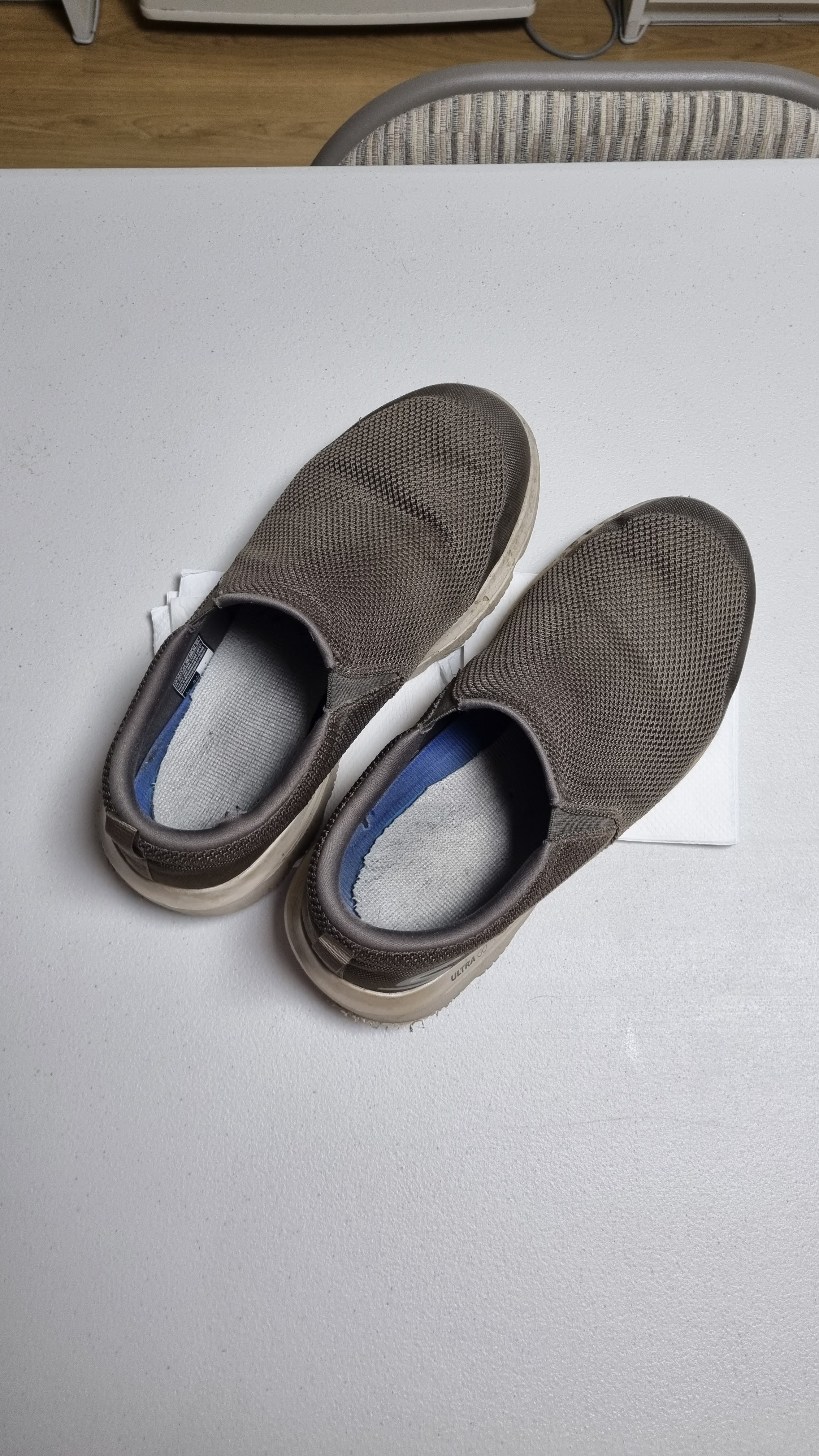 |
| 11/12/23: how the shoes looked once I got to my place |
 |
| some wear and tear at the heels |
 |
| the flattening-out on the outsides of the soles is largely due to supination |
 |
| One flaw was the soles' tendency to grab and hold pebbles. |
 |
| more flattening visible |
 |
| pebbles closeup |
 |
| another pebble trapped deep |
Let's go over some other items, from clothing to equipment:
Shirt. My self-designed Teespring (now Spring) black tee survived and got faded in the usual way, mostly at the shoulders, by the end of the walk. It was thick and heavy enough to help protect me, somewhat, from the cold. No holes developed. The shirt did get twisted around my torso a bit, which is something that happens to all of my tees whether I'm on a long walk or not.
Cargo pants. My cargo pants got through the experience just fine. If they could talk, they would probably aim some vituperation my way for not washing them more often. I think I washed them maybe twice or three times over the course of the month, mainly to make sure I didn't stink too horribly when I found myself among civilized people. NB: my shirt got washed every few days. Underwear was washed daily.
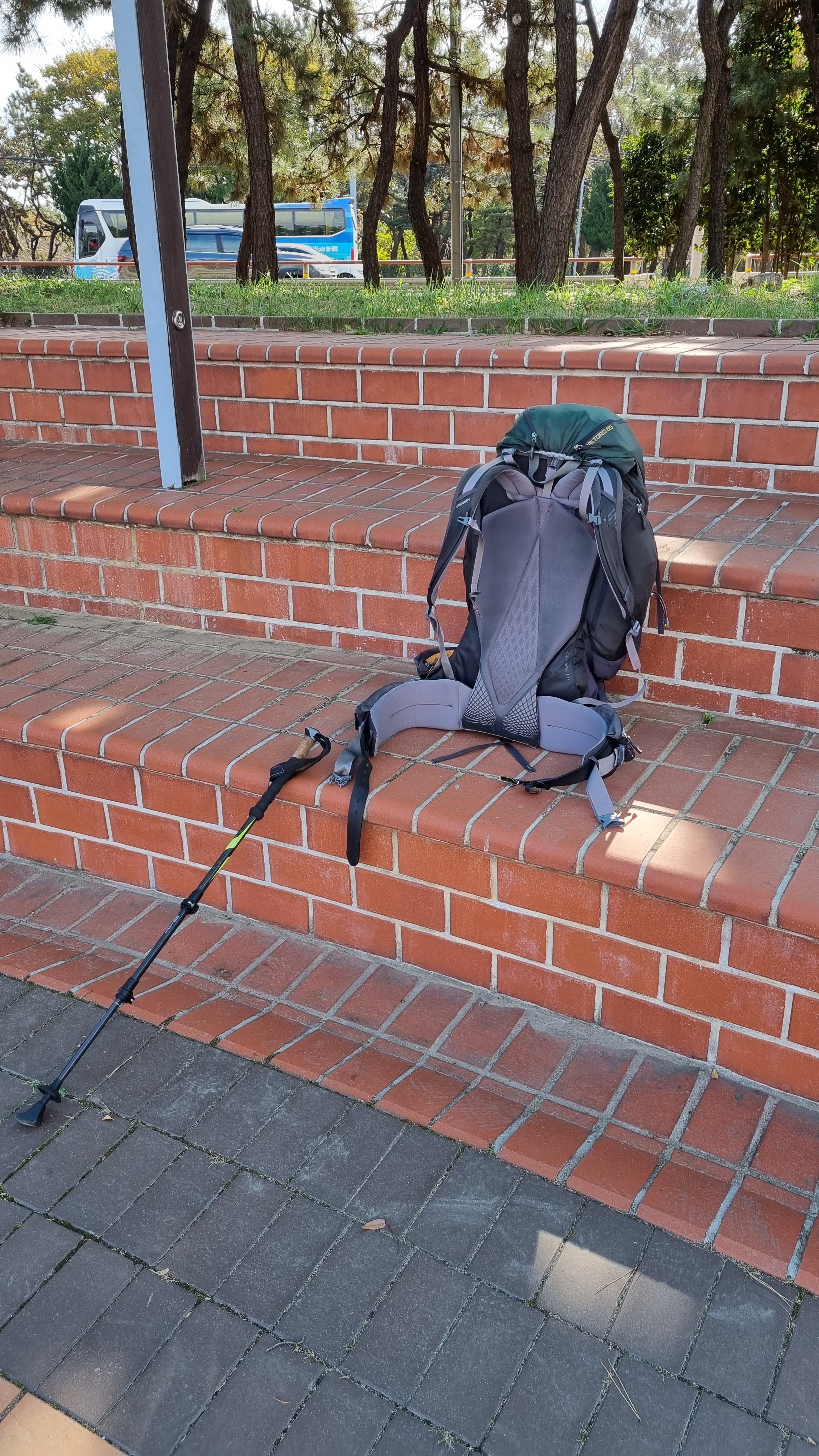
Belt(s). There was the belt I wore to keep my pants up, and there was the belt I fed through my hip-belt assembly to keep my pack's weight on my hips and off my shoulders. The pants belt was this weird, stretchy, made-in-China thing with no actual holes: the belt was made of some sort of woven material, and the idea is that you pull the belt as tight as you want or need, then you stick the buckle's prong through the belt's fabric. No specific holes. I guess this prevents too much wear and tear because you're never going to put the belt buckle's prong through the same part of the belt twice. This was a strange sensation, at first, not using standard belt holes, but I got used to it: you get a feel for the belt's proper tightness after a while. The major disadvantage is that you can't use such a belt to check your weight-loss progress, so I turned to my hip-belt assembly instead. The heavy leather belt that I fed through the assembly lasted the entire trip, but there were some moments, on the trail, when I wondered whether the belt was going to pop right at the point where a flattened screw held the belt in a bent-backward loop that trapped the buckle. I would have had to figure out a way to replace the screw had that happened, but luckily, the belt held together. I had punched extra holes into the belt in anticipation of some weight loss, and if you followed this journey, you know I lost three inches off my waist (which translated to an 8.5-kilo, or 18.7-pound, loss). In fact, by the end, I was barely able to use the native hip belt that came with the Gregory Baltoro 85 backpack—something I couldn't do at the beginning of the walk.
Poncho & windbreaker. I did this walk about three weeks later than I normally do it. This meant more rain, and it also meant more cold. I've said many times, on these walk blogs, that I despise the soul-crushing, morale-sapping combination of rain and cold: it truly is discouraging. To prepare for both of these problems, I brought along my re-waterproofed windbreaker and my poncho. I often wore both on cold mornings: they blocked out wind and provided an insulating layer of warm air that surrounded my torso, so I never needed a heavy coat. (The poncho's armpits were open, so it was up to the windbreaker to retain heat in that part of my body.) I think, overall, the poncho proved more water-resistant than did the windbreaker which, despite its re-waterproofing (I'd sprayed it down with a special sealant maybe a month before the walk), proved to be shite at keeping the rain out. But the poncho had wide-open spaces to it (I fixed some of that by using my hip belt), so it wasn't totally proof against the rain, either. As a result, I went through a few miserably cold, rainy days, but I was protected enough to get through those days without major discomfort.
Sheath underwear. Suckered in by the shilling of YouTube cook Adam Ragusea, I had bought myself a very expensive pair of Sheath brand underwear. Sheath's claim to fame is that the underwear's architecture is designed with a jockstrap-like pouch for your scrote and a hole for your crotch dragon to poke through (there's a layer of cloth on top of that to keep you from flashing the whole world at inappropriate moments). Ultimately, I found my Sheath underwear to be a bit uncomfortable—not horribly uncomfortable, but noticeably so. I think I'll go back to wearing the Spandex biker pants that had gotten me through so many previous walks. I never wear figure-hugging Spandex as my outer layer since I have no figure to show off, but I do like the slip-slide quality of Spandex as a way to prevent my inner thighs from chafing.
And maybe this is the time to confess I suffered something of a scrote problem when I got to Yangsan, the final city before Busan. It's a really good thing that I normally stay in Yangsan for two nights because, as it turned out, I randomly plucked at a scrotal scab (I have Fordyce's angiokeratoma, which sucks: harmless but incurable; not infectious but looking like an STD... basically, blood blisters on my balls) and caused a minor but very steady bleed that, for hours, simply would—not—stop. I wasn't in danger of bleeding to death, but the awkward position of the bleed, when I discovered it (via a slick feeling of blood on my fingertips), meant that I was guaranteed to leave a patch of blood on my bedsheets the moment I rolled off my mattress to hit the bathroom. Sure enough, I left blood on the sheets like a girl having her first period. I did what I could to stanch the bleeding while I sat on my motel room's smart toilet (my final smart toilet for the trip). The bleeding didn't stop at first, but it slowed to a point where I could pad myself with some toilet paper and not worry about soaking the paper with blood. I then used the motel room's shampoo and a bottle of water to do what I could to tackle the bloodstain on my mattress. This all happened during my first night in Yangsan. By the following day, I was no longer bleeding except for a single drop or two on occasion; I prepped my one and only gauze pad, from my first-aid kit, to act as a man's tampon for my final day's walk (that's right: I walked to my endpoint with gauze in my crotch). The bloodstain on the mattress was still slightly visible, but it no longer looked as freakish as it had the previous night.
Did Sheath help to contain the bleeding at all? I don't think so, but the underwear kept my gauze pad in place during the final walk to Busan, so there's that.
Gloves. Over the course of the trip, I ended up buying two pairs of gloves—the type used by bikers to protect themselves from wind—and in each case, I somehow stupidly managed to lose one glove from each pair. The gloves proved to be necessary for only a few days out of the 29-day trek, but they were a lifesaver on those truly cold mornings. Now that I'm back home, I've gotten rid of the single remaining glove from the walk because, here in my apartment, I've got my winter gloves, which are much thicker and less likely to be lost because I'm no longer trekking across the country. Still, I'm glad I had those gloves, even if only for a short time.
Bandanna and toshi. My new bandanna, bought just this year and bigger than my previous bandanna, worked out great, but as usual, it left me with an un-suntanned forehead that now acts like a great, big lighthouse beacon, shining out at anyone I encounter on the street or in the office—a nice contrast with my tanned and freckled face. My toshi/토시 (sleevelets) protected my forearms in much the same way, leaving them untanned. My hands and face, though, got almost the full brunt of the sunshine during the walk, with my hat providing some protection. If anything saved me from severe burning and peeling, this time around, it was the time of year. By doing the walk three weeks later than usual, I apparently spared myself the harsh effects of the late-summer, early-autumn sun. Unlike in previous years, my toshi didn't rip after getting caught on anything, so I can use them again next year.
Hat(s). My hat supposedly served the purpose of protecting my face and neck from the sun. I started off the trip with my ridiculously huge-brimmed new hat, but it proved problematic because the back of the brim kept bumping against my backpack, so when I was in Yangpyeong, I found a military-surplus store that sold a hat more like the other, smaller-brimmed hat I had left at my apartment. This hat proved to be a lot more comfortable, but it still bumped slightly against my backpack, causing minor annoyance. On walks that lasted until the mid or late afternoon, it was a relief for me to take my hat off and let my head breathe a bit more as the sun got lower in the sky (I also had no reason to wear a hat in the early mornings before sunrise). I suppose the hat did help to keep the worst of the sun off my face and nape, but I may have to resign myself to getting one of those backpacker-specific hats—the ones with no brim in back, but with a draping protective cloth to keep the sun off your neck (see here for example).
Contact lenses. At some point, months before the walk, my right-hand contact lens acquired a tiny rip that looked almost as if a mouse had taken a tentative nibble off the edge. Oddly, when I first noticed the bite-shaped rip and tried the lens again anyway, there was no pain or irritation, so I thought nothing of the damage and kept using the lens despite knowing I had a spare stashed away in another lens container (long story). The lens lasted throughout the entire walk, never once irritating me, but in the weeks since I've been back, the lens suddenly became irritating, so I finally had to throw it out and resort to my spare lens. I recall being worried, during the walk, that something might go wrong with the ripped lens, and that I'd have to complete the walk wearing only one contact. I was prepared for that eventuality; I've walked around with a single contact before, and I've even gotten around with no lenses at all. Luckily, things worked out well, and the damaged lens didn't become a problem until I was safely home.
Cell phone and Naver Map app. Oh, what would I do without my cell phone? Elon Musk is right: we're all cyborgs now because our cell phones are essentially externalized parts of us. During the walk, I used my phone to stay current with the news, to watch YouTube when I was at a motel, to read other people's blogs, to check the weather before going to sleep and after getting up, and of course—to take photos of the walk and to write my blog posts. My Samsung Galaxy S21 is a huge upgrade from my S14, especially when it comes to data storage: I went from being able to store 64 gigabytes of data to 256 GB. This meant that I could take as many pics as I wanted and not have to worry about doing "pic dumps" to save storage space. Oh, and I occasionally even used my phone for phone calls.
While I'd like to think that I can now navigate the Four Rivers path by memory (something I might try next time), the truth is that I still get turned around. This is often the result of unmindfulness on my part, but it's also often because parts of the path are poorly marked, which means I have to rely on my Naver Map app to help me get unfucked. It doesn't help that the path is slightly different every time I walk it. As I've said before, the Four Rivers trail is more like a network of trails all tending in the same direction. So Naver was my guide for a good portion of the walk, especially around the Saejae (middle) segment. I have most of the Han River portion committed to memory, and the later part of the Nakdong portion is easy enough to navigate since it rarely departs from the river, but the middle of the Four Rivers can still confuse me, so I can't wean myself off Naver quite yet.
Clothesline. It's such a random thing, the decision to take along a length of clothesline just because there's a little, pixie-like voice in your head whispering Just in case. But I'm glad I had the nylon line this time around because I ended up using it a few times for hang-drying my clothes. Most motel rooms usually have a plethora of hooks and other surfaces on which to hang or drape hand-washed clothing, but some rooms are a little more spartan, which means I have to create a surface on which to hang things. Sometimes, the clever use of my trekking pole is enough (I wipe it down first before using it to hang clothing). But at other times, the clothesline is the way to go. I'm glad I took it along.
First-aid kit. Thanks to my toe damage, my first-aid kit saw a lot of use. It was one of the first things I would break out every time I arrived at a motel. Strip down, hand-wash my clothes, poop, shower, then tend to my poor feet. Thanks goodness for the med kit.
Bivy sack and other camping equipment. I've begun to think that using a bivy sack is a mistake for me. For campers who are fine with bivy sacks, God bless you. Keep doing your thing. For me, though, this latest walk was proof that I need to go back to a roomier pup tent. I miss my old Big Agnes tent, but my camping needs on this sort of trail are more of the free-standing tent variety—no stakes needed. When I'd used my bivy sack on previous walks, condensation was never a problem, but this time around, on the one night I camped, condensation was a big problem. I'm sure that one reason for the condensation was that, despite plenty of experience camping, I'm still prone to making rookie mistakes in defiance of common sense: there may be something I could've done, for example, to improve air circulation in the bivy. And on that note, it could be that my problems are specific to bivy sacks. I don't recall having any problems, ever, with my old Big Agnes. Otherwise, my sleeping bag and foam mat functioned fine. I slept fully clothed but with my shoes left outside the bivy. I didn't worry too much about creepie-crawlies getting into my shoes because this wasn't true wilderness camping. With the bivy being self-supporting (it comes with a segmented, flexible tube that you push through a cloth channel to create a semicircular "rib" that props the bivy up around your head/torso area), I didn't need to use my trekking pole to prop anything up.
There was a moment, maybe sometime during the first two weeks of the walk, when I passed by a biker who had set up camp at a modern-looking shwimteo, his bike standing at the ready next to his tent. This was one of those free-standing tents I'm thinking about getting, and he had simply laid it out over the wooden flooring of the shwimteo. I felt a stab of envy when I saw that setup. It's roomier and more comfortable; there's less of an airflow/condensation issue in such a space. If I ever camp on the trail again for whatever reason, I'd rather have that sort of tent even if it means carrying an extra pound or two. A pound or two won't make a material difference, as I discovered when carrying varying amounts of water with me.
The Gregory Baltoro 85 backpack. Ever since I bought my Gregory Baltoro 85 in 2018 to replace my old Gregory Whitney 95, which gave up the ghost, the new pack has proved to be a faithful workhorse. One day, the Baltoro too will wear out, but for the moment, it's shown itself to be quite sturdy and has already done several long walks with me. In 2018, I did a 130K test walk with the Baltoro to Incheon and back to my place. 2019 saw the Baltoro in action on the Four Rivers trail, then again in 2020. In 2021, I tackled the Korean east coast without the Gregory (it was a no-camping-needed route, what with all the pensions and motels), and again in 2022, the pack got a break because I used a smaller backpack while walking around Jeju-do. Now, it's 2023, and the backpack, back on duty, is still going strong. Part of me still has trouble trusting that chest strap, though: I keep expecting it to pop off the way the chest strap kept popping off on my old Whitney, but the Baltoro's strap has, thus far, held firm. I still travel with a spare chest strap, though. Just in case.
Note there's always one piece of equipment I never talk about despite spending one month a year outdoors: sunglasses. I don't wear 'em. Maybe because I don't feel I need 'em. Things might get glare-y on occasion, but I don't spend my hiking days staring into the sun, so I never take along sunglasses. Does this make me weird(er than usual)?
Overall Thoughts
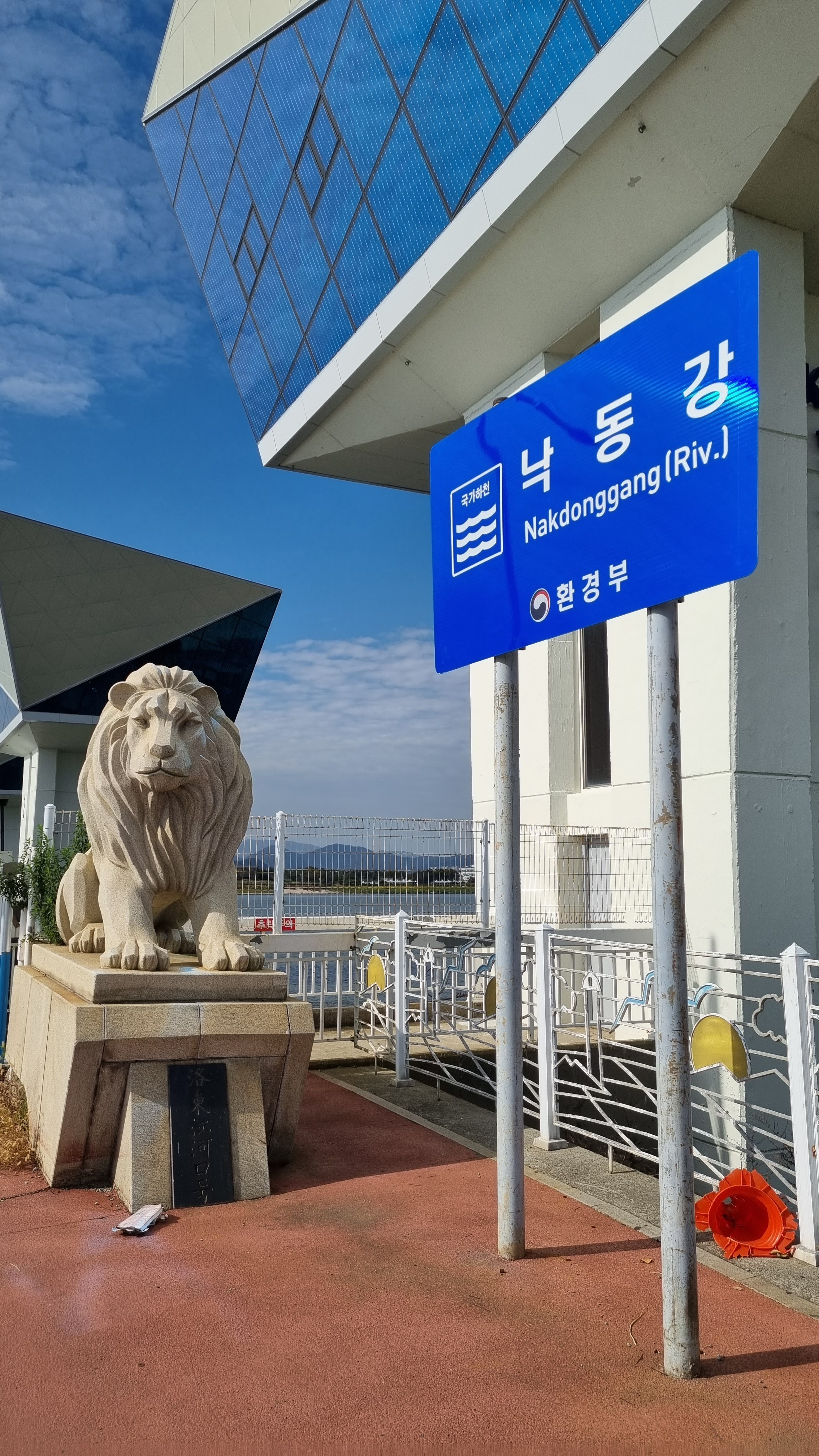
I was all over the place on the final day of the walk. Unlike previous years, I didn't linger long at the endpoint—the Nakdong River Estuary Barrage Certification Center (낙동강 하굿둑 인증센터/Nakdong-gang Hagutduk Injeung-senteo)—because I knew I had a meet-up with my friend Neil, who had mentioned that he'd be arriving early because there were only four buses a day to Busan from his town of Masan. I had gambled on getting a hotel room at the Westin Joseon (Josun) Hotel, but it was the weekend, so I knew there was a chance I wouldn't be able to just walk in as I'd done during the east-coast walk. Sure enough, the apologetic lady at the front desk of the Westin said the hotel had no available rooms, partly because construction was happening on several floors, and all the remaining group rooms had been reserved already. This meant I'd had to cab across town to Busan Station to book a room at my usual motel when I'm in Busan—the humble Gwangjang, which sits literally next to the train station, thus making it easy for me to depart for Seoul the following morning.
So the cabbing chronology was something like this: from the Four Rivers endpoint, I cabbed out to the Westin, where I discovered I wouldn't have a room. I then cabbed across town to Busan Station, booked my motel room and put down my backpack, and cabbed back to the Westin to meet Neil. After Neil and I had dinner at the Westin's Camellia buffet, I cabbed back to the Gwangjang. So that was four trips across town in a cab—a lot of cab fare. I was tired and beyond caring, though, and the cab rides gave me a chance to stare out the window and look Busan over. When I wasn't nodding off, that is.
I have mixed feelings about Busan. Being so far south, the city is filled with people who all speak Korean with that annoying southern accent. I never get used to that even though the people I've encountered in Busan have generally been nice (except for that one old man who barked at me for not wearing a mask back when I did my east-coast walk in 2021). I also remember the contrast between walking across town via the Four Rivers path and cutting west across town in 2021: when I do the final stretch along the Four Rivers path, the walk is normally quite pleasant despite the omnipresence of traffic. But in 2021, the cross-town walk wasn't along a tree-lined path: it was all sidewalks and traffic lights and pedestrians. Very urban and in-your-face. I didn't like that at all.
At the same time, the view from a moving cab was something else. Busan by car, with the cityscape gliding past you, shows you right away that the city skyline blows away anything we have here in Seoul: raised expressways describe sweeping curves; glass skyscrapers and ports and heavy industry are everywhere, and the terrain itself is mountainous, with much of Busan being built all over those mountainsides. The Gestalt is quite impressive. I'd like to visit Busan for an extended period just to explore the place. I've still never used its subway system, which could probably save me a bundle in cab fare. I'd probably concentrate on the city's food scene; like Seoul, Busan has become an international foodie mecca. But there's also the district dominated by Centum City, a comparatively recent build that is a modern business district and, from what I understand, a good place to shop and eat. While it sounds a bit tourist-trappy, it might be worth at least one visit.
Another insight I had during this hike is that I'm not getting any younger, and this sort of thing is not getting any easier. Especially as I creep inevitably toward 60, I often wonder how many more of these yearly hikes I can do. I'm lucky to work where I do, and I'm lucky to have an American boss who is understanding enough to grant me a month every year to get this sort of walk out of my system. At this point, I'm so thoroughly addicted to this kind of distance walking that I'm pretty sure I'd go crazy if I didn't have the chance to do it. I also know that many of my problems, while walking, are all related to weight: lose the weight, and most of these problems will disappear. I lost some weight during this walk (see above), and my heart rate went down, too (again, see above). As I've said many times, I'm my best self when I walk: waking up early, exercising all day, practicing a self-discipline that seems to come more easily during this month-long project than it does at any other time of year. But despite being my best self on these walks, I am getting older, and while doing this sort of walk isn't hard, per se, there will come a time, fairly soon, when such walks do become difficult.
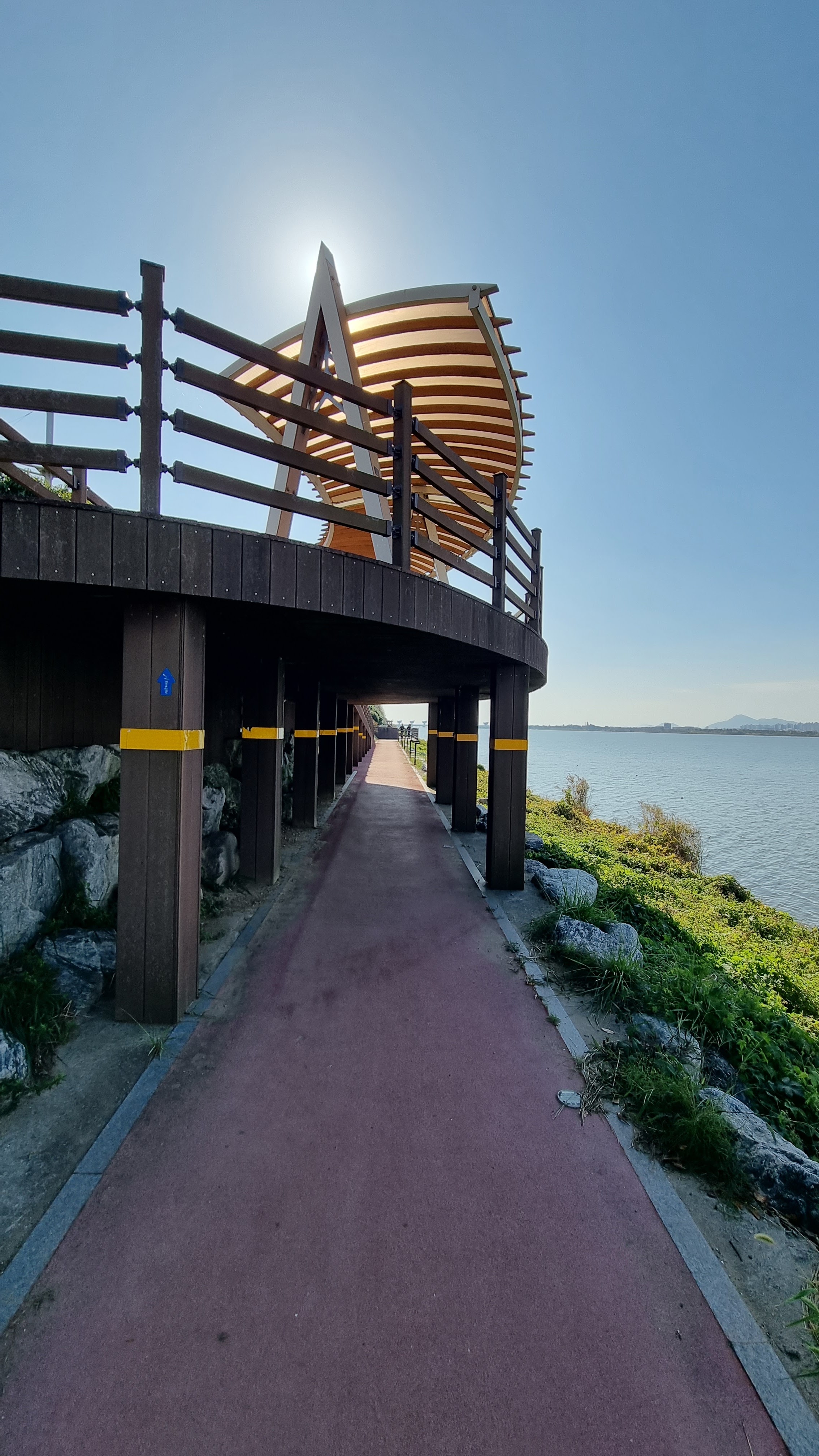
It was good to be back on the Four Rivers trail after some time away from it. The last time I'd been on it was in 2020—three years ago—so returning to this trail was like meeting up again with an old friend. This is still my favorite path. The trail remains comfortingly familiar, but as with every walk, there are always differences in the details—not just minor tweaks in the walking route itself, but also changes resulting from weather conditions, the time of year, the people I pass during the walk, etc. The mix of old and new is a welcome one, and I'll always love this trail. It was my first, and it's still the best.
As always, I was impressed by the sheer amount of agriculture I passed as I walked. I was partly right and partly wrong about how things might look, given that I started this walk almost a month later than I usually do. The rice harvest, in some areas, seemed to be happening very slowly; in other areas, everything had already been harvested. The replacing of old crops with new, different crops, i.e., crop rotation, was an interesting thing to see, especially with all of the fresh garlic and late-season cabbage that I saw in so many fields. Agriculture really is the backbone of this country, and I have nothing but respect for the hard-working farmers (even if I don't agree with their attitude toward international competition).
So: time of year. Was the later start ultimately a good thing or a bad thing? I can say that starting later meant more rain during this walk: this was easily the rainiest walk I've ever done aside from Jeju, where the rain was arguably worse. But the sun was less harsh, and the weather was gorgeous on the non-rainy days. The cold was worse when I was in the north, but as I moved south and east, it became less and less of an issue. Overall, I can see myself doing this route again at the same time of year. I'm experienced enough at this sort of distance walking that I have no reason to bellyache when it rains: I normally have the equipment I need to protect myself and my backpack from the elements.
And about that: the question of being "out in nature" or "away from civilization." I have to laugh: there's a real sense in which what I'm doing is the exact opposite of roughing it. The very fact that I'm walking a bike path from Incheon to Busan—well the bike path itself is a huge sign of human civilization, so it's not as though I ever leave civilization when I do this sort of walk. I'm under no illusions about that. Maybe I could expand my horizons by making things more difficult for myself, perhaps by trying the walk during the summer or during the snowy winter. Thus far, I've walked across South Korea only in the spring and the fall, i.e., the most beautiful and clement times of year. And for the most part, I'm sleeping in motels and pensions, using my camping gear only on the rarest of occasions. So how "out in nature" am I, really? Not very, I should think. Yes, the distances involved require a bit of work, but even there, I'm not doing a month-long string of 60K days at over 5 kph the way some distance walkers do. No: overall, I have it easy, and while I do end up with rough, tanned skin and lots of freckles from my exposure to fresh air and sunlight, nothing I'm doing is all that praiseworthy. I can't even use my stroke as an excuse to fish for praise: my stroke was relatively minor; at best, it's the reason I walk a bit more slowly now, but that's about it.
What the New Routes Taught Me
Remember that one 25K shortcut I took to get to Jeokgyo-jang Motel to avoid the 39K route? I've decided that I'll never take that route again. Too much traffic, too much walking on narrow road shoulders, too much resemblance to some of the unpleasant walks I did along the east coast in 2021. I'd rather suck it up and walk the 39 kilometers to Jeokgyo-jang along the proper bike path. That would keep me closer to the river and allow me to see one of the dams that I missed this time around, as well as some stretches of the path that I remembered from last time but bypassed this time. I do love those dams. I love all the examples of Big Engineering I see along the walk, including the many impressive bridges.
I think there was another shortcut I had done... I'll probably stick to that one.
Stuff to Find Out/Explore
By the end of the walk, I was left with questions, and this winter, I'll probably head out to answer them as long as it doesn't snow. First: by Sangpoong Bridge in Sangju City, there's the matter of that one place that might or might not be a pension. I'll go back to Sangju and spend the day walking out to that spot from the bus station (if it's a feasible walk). Once there, assuming the place is open, I'll talk to whichever staffers I find to determine whether it truly is a pension that is open during the time of year when I normally do my walk. Second: there's that one frustrating route, on the approach to Namji, where the official bike path goes one way, but Naver Map insists that I have to go the opposite way. This is perennially frustrating because the bike path stays next to the river, and it also looks to be a shorter route. But since Naver tends to warn people away from certain hazardous or strenuous paths, I'm wondering whether the official bike path, at that point, is somehow too hilly or something. So I want to go back down there and walk the unwalked path to find out what I've been missing. Naver sends me in the opposite direction every single time I'm down that way, so it really is time to discover what's up.
Conclusion
Overall, despite the aches and pains, despite the getting-lost, despite the cold and the rain and all the other major and minor problems encountered this time, I was so happy to be back on the Four Rivers trail. To me, it's far better than the east coast, and despite Jeju's inarguable beauty, better even than Jeju. Next year, I think I'm going to do the trail one more time, tweaking the route so that I won't have to camp at any point. If I tweak things correctly, there'll be no need to take along camping equipment and thus no need for the Gregory Baltoro, so as happened in Jeju, I'll be back to using a much smaller backpack to reflect a significantly lighter load. (I can also go back to using my ridiculously wide-brimmed hat!) I might even consider next year's walk a good trial for the Camino de Santiago which, from what I hear, has facilities all along its length, every 5-10 kilometers. If that's true about the Camino, then training for a camping-free hike in Spain strikes me as the way to go.
I'm sorry this postmortem took so long to put up, but I had a lot to say, not to mention plenty of final photos to put up. If you want to see updated photos of my healing feet (and yeah, I know most of you are sick of foot photos, but my feet are one of the major realities of this sort of endeavor, so I won't apologize for uploading visuals of something that is truly important to me), keep an eye out for them at my main blog.
So—that's a wrap for Kevin's Walk 7, 2023. All I have left to do, now, is to enlarge and caption all my photos. I hope to get that done before the new year. Come back here around late December to see how far I've progressed. Thanks for reading! And until we walk again!


