This entry's title says "the end," but there are several more things that must happen before Kevin's Walk 7 wraps up. I have to write my postmortem; I have to upload the full photo essays for each day; I have to enlarge each photo in the photo essay; I have to caption most of the photos. The postmortem and initial upload will probably take me through the coming week; the enlargements and captioning will take longer, maybe a month or so. The people with no patience will abandon the blog before then, and that's fine; the dedicated folks will wait for word on my main blog that the enlargements and captioning have been done.
So, how'd the final day go? As always, it's hard to believe I'm on the other side of such a project. True, Korea's a small country, so this isn't like walking across the mainland US or Australia. But 600-plus kilometers (about 615 this time, or 382 miles) isn't nothing, either.
The day started off cold and—once again—fog-free. I somehow managed to lose my new left glove, so that was irksome, but it turned out I was able to function fine for a time with one hand gloveless and stuffed into a jacket pocket. After an hour or so, there was no need for either glove, so I removed my right-hand one and, aside from a bit of stiffness, had no problems.
What's really beautiful is that I finally figured out the definitive way to exit Yangsan: there's a footbridge by Mulgeum Station; walk over it, and you're right where the bike paths are, then it's a straight shot to get back on the proper Nakdong River trail. It took six years for my slow brain to figure that out, but now that I know the route, I'll be using it from now on. It's much better than the twisty, circuitous route I'd been taking up to this point.
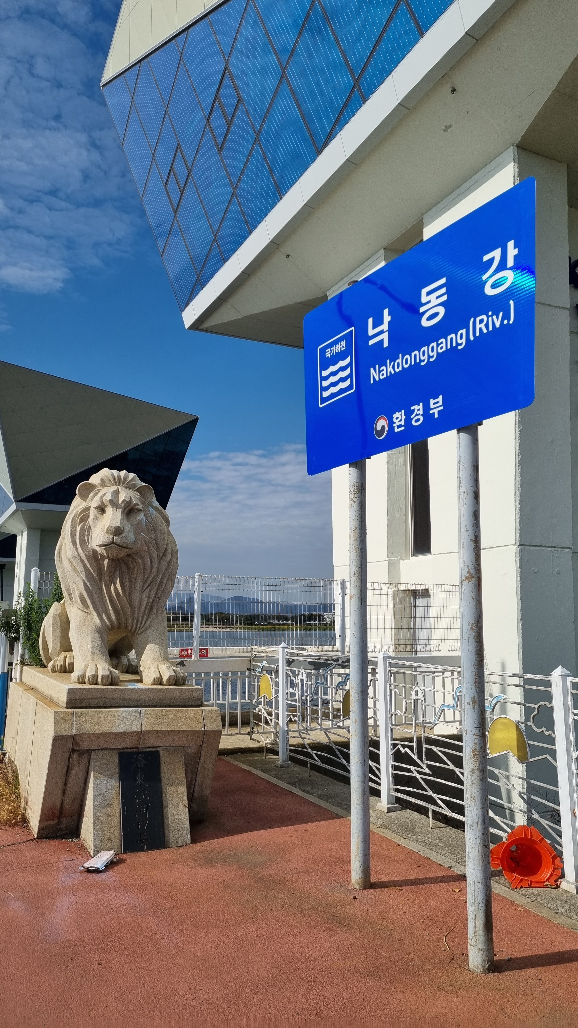
Once I was out of Yangsan, I basically went on autopilot because I knew the rest of the route by heart. It's essentially a straight shot along the Nakdong's east bank down to the goal: the 낙동강 하굿둑/Nakdong-gang Hagutduk/Nakdong River Estuary Barrage, a sort of dam that sits at the point where the river meets the ocean. More precisely, the end of the Four Rivers path is the certification center located just beyond the estuary barrage.
The early morning was dominated by old people, all agitated and unable to sleep, walking or biking along the path, or playing break-of-dawn park golf. I've come to realize that I hate park golf as much as I hate seeing all the pollution strewn along certain parts of the Four Rivers path. I realize old people need something to do, but they need a better activity than fucking park golf. Engage in a litter-collection campaign, practice seonmudo, something. Later in the morning, younger people made an appearance, playing real sports like soccer and baseball.
The walk was simple, straightforward, and mostly happy. There was some irritation when obnoxious bikers strayed into the pedestrian lane, but it was a beautiful day, and I couldn't bring myself to dwell on other people's obnoxiousness.
One hitch occurred when I discovered that a stretch of one of my favorite portions of the path was under construction. I avoided the construction zone by skipping off the tree-lined berm and down to a parallel street for a spell. I then went right back up to the top of the berm when I was pretty sure I was past the construction zone. As I said: navigating is easy when you're just following a river.
For the first time, I noticed all the airplanes on final approach, flying alongside the Nakdong to Busan's airport. They looked tiny in the distance; I snapped a few shots of them.
The tree-lined berm is a stretch that goes on for nearly seven kilometers. After that, you've got the final 5K to your goal. At about the 4.5K-to-go mark, you can clearly see the estuary barrage in the distance. There's nothing left of the path but this straight march to the certification center. I nodded at passing bikers in greeting all morning. Some were kind enough to nod back; others merely stared rudely at me as they passed.
The last kilometer takes you across the barrage and into a park-like area that has several buildings, including one devoted to the history of the region's "aquaculture." The park has a very important-looking tower that is probably the most recognizable landmark for bikers finishing the Four Rivers trail. There's also a large, carved rock that marks the official start/end point for the trail. I took a perfunctory selfie at that rock, used the restroom on the premises, then left soon after to get a hotel room and meet my friend Neil.
I felt bad because Neil lives in Masan, close to Busan, and there are only four buses a day running from Masan to Busan and back. So even though our dinner appointment was at 5:30 p.m., Neil had no choice but to be in Busan by 2:30-ish. After our dinner, I was feeling the gravitational pull of postprandial fatigue, so I cut things short and went back to my motel, the Gwangjang (W55,000 a night), at around 7:40 p.m. Neil, meanwhile, was forced to wait until his 9:30 bus.
Dinner at the Westin's Camellia buffet was excellent. The selection included shepherd's pie and filet mignon, both done up perfectly. I think I ended up having about five plates of food. Conversation with Neil ranged all over, from fitness and nutrition to politics and education. Neil brought up his wife's cooking prowess, which I experienced firsthand some years back.
In the end, I wasn't able to get a room at the Westin, so I went all the way over to Busan Station and got a room at the aforementioned Gwangjang, where I've stayed twice before. It's a solid, reliable motel with decent WiFi and no special features. Bouncing back and forth between the Westin and the Gwangjang cost me both time and money (in terms of cab fare); I was tired and nodded off a few times during my cab rides.
I don't think I ever went faster than 4 kph today; if anything, it looks as if my average speed was around 3.6 kph—faster than my average for most of the month, but still slower than I was before my stroke. Ah, well; loss of speed is the new normal, I guess. I still managed to reach the end of the trail by 1:26 p.m., which is fairly early. The early stop time also indicates that I probably didn't walk 30K; it was more like 27 or 28K.
Right—I'm cross-eyed with fatigue and in desperate need of sleep, so I'll leave you with the usual info and images (more than ten). Expect a postmortem and pic dump soon.
 |
| kind of the route I did, except for the beginning part |
 |
| definitely not 30K |
 |
| preflight selfie (around 4:30 a.m.) |
 |
| the footbridge over the train station |
 |
| straight shot to the river |
 |
| the first sign I'm in Busan: the Nakdong River Bridge |
 |
| the second sign I'm in Busan: this cluster of apartment complexes |
 |
| passing through parkland |
 |
| underpass |
 |
| straightaway on the tree-lined berm |
 |
| almost at the barrage |
 |
"1K to go," the lion with the axe-cleft forehead rumbles. The five Chinese characters below the lion say, Nakdong-gang Hagu, or Nakdong River estuary. The final syllable is written in Korean; it says duk, referring to the dam-like barrage. The bit of trash at the bottom of the photo bothers me to no end, but I photograph what I photograph, with nothing staged (unless I'm posing). |
 |
| the important-looking tower at the end |
 |
| Camellia: filet, abalone, cream-bacon pasta, shepherd's pie |
 |
| filet, pork belly, japchae, shrimp/zucchini, beef/asparagus |
 |
| dessert |
PHOTO ESSAY
 |
| 4:30 a.m. |
 |
| bye-bye, Bliss |
 |
| Moving toward Mulgeum Station, where I will cross a bridge and end up in parkland. |
 |
| the bridge in question... even at this hour, there are people about |
 |
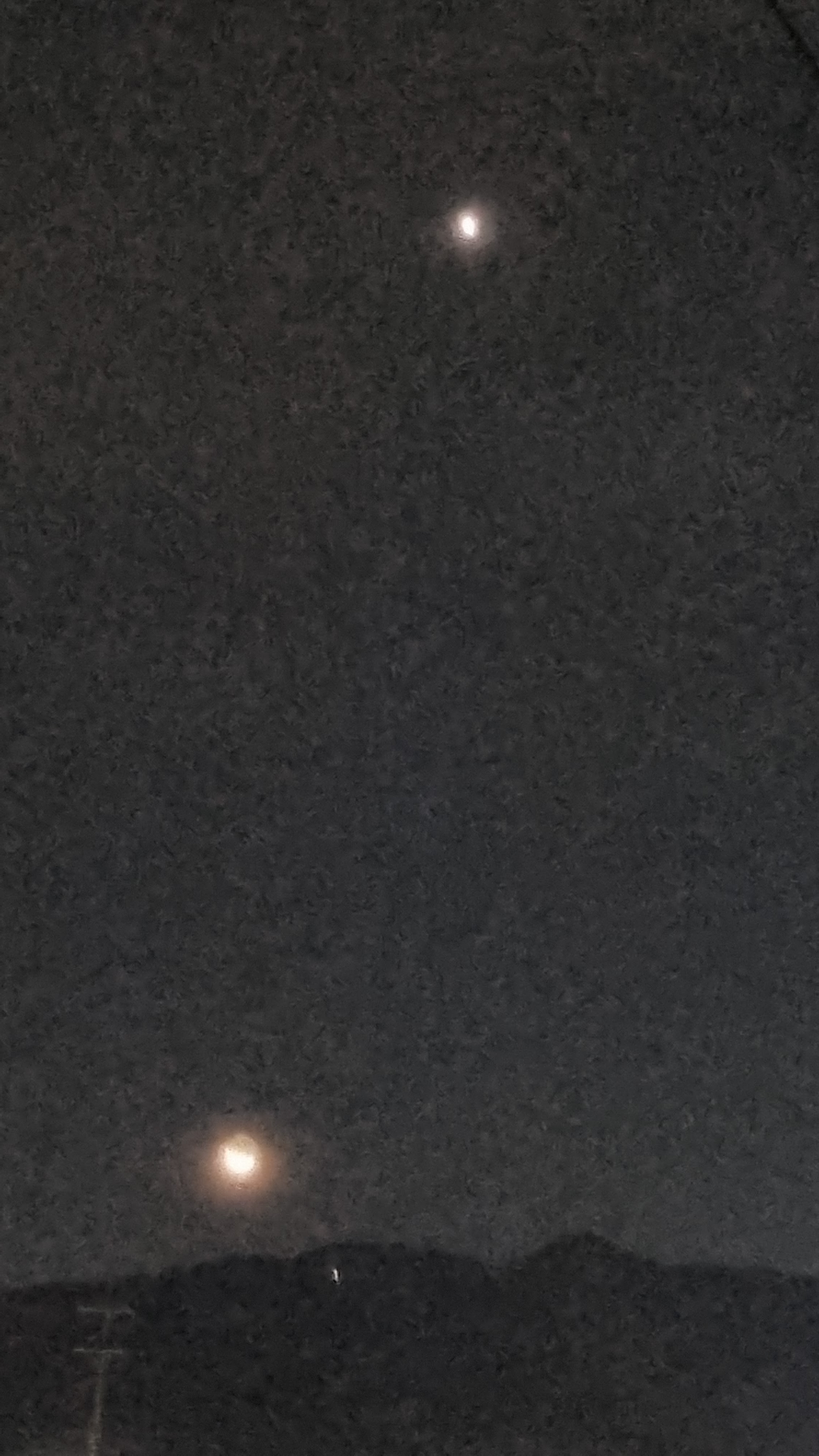
| Venus |
 |
| still Venus |
 |
| Crossing. Sorry for the blur. |
 |
| Jupiter |
 |
| Joongbu Plaza |
 |
| The walk to the river is a straight shot from here. This route is new to me, but simpler than previous routes. |
 |
| Hwangsan Park |
 |
| Luna |
 |
| animal assholes |
 |
| moon and Venus, one last time |
 |
| Hwangsan Healing Forest |
 |
| I'm about to leave the nice, neat, well-lit, smoothly paved part of the route. Things are going to get darker and rougher. |
 |
| Sorry again for the blur. |
 |
| Hwangsan Park Cycle Roads |
 |
| Here we go: darker, less well-lit, and rougher. |
 |
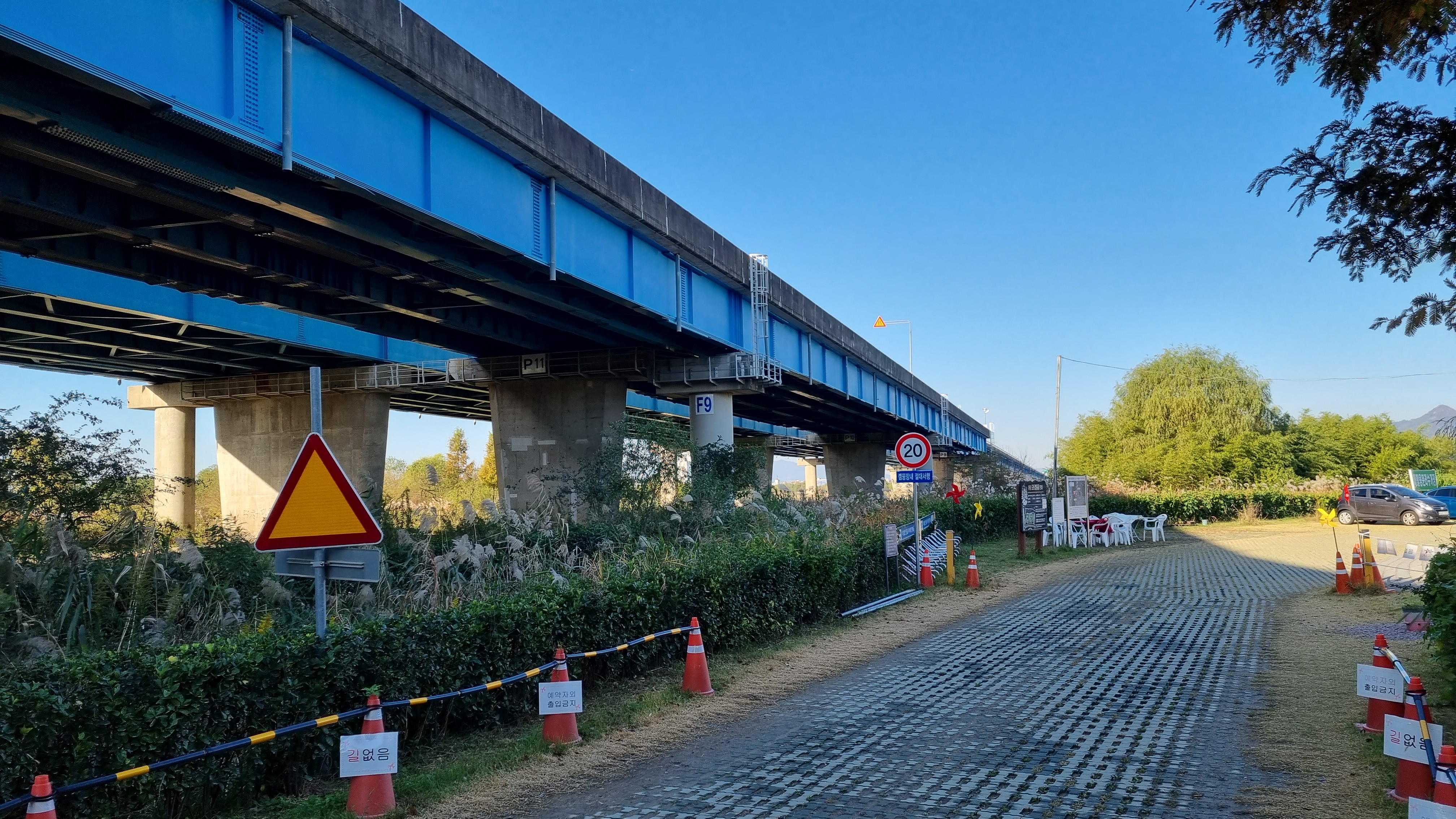
| ramp up to a bridge to cross the Nakdong |
 |
| 호포교/Hopo Bridge |
 |
| looking back |
 |
| The graffito, from left to right, says, "Annyeong, bye, ride carefully!" |
 |
| Someone sprayed out the Roman alphabet, then someone else probably added the "uck you" next to "F." |
 |
| The sign I've been following since Sangju. |
 |
| swerving right and to the river |
 |
| Here's the 낙동강대교/Nakdong River Bridge, as mentioned a few days earlier. |
 |
| Nakdong River Bridge, up close |
 |
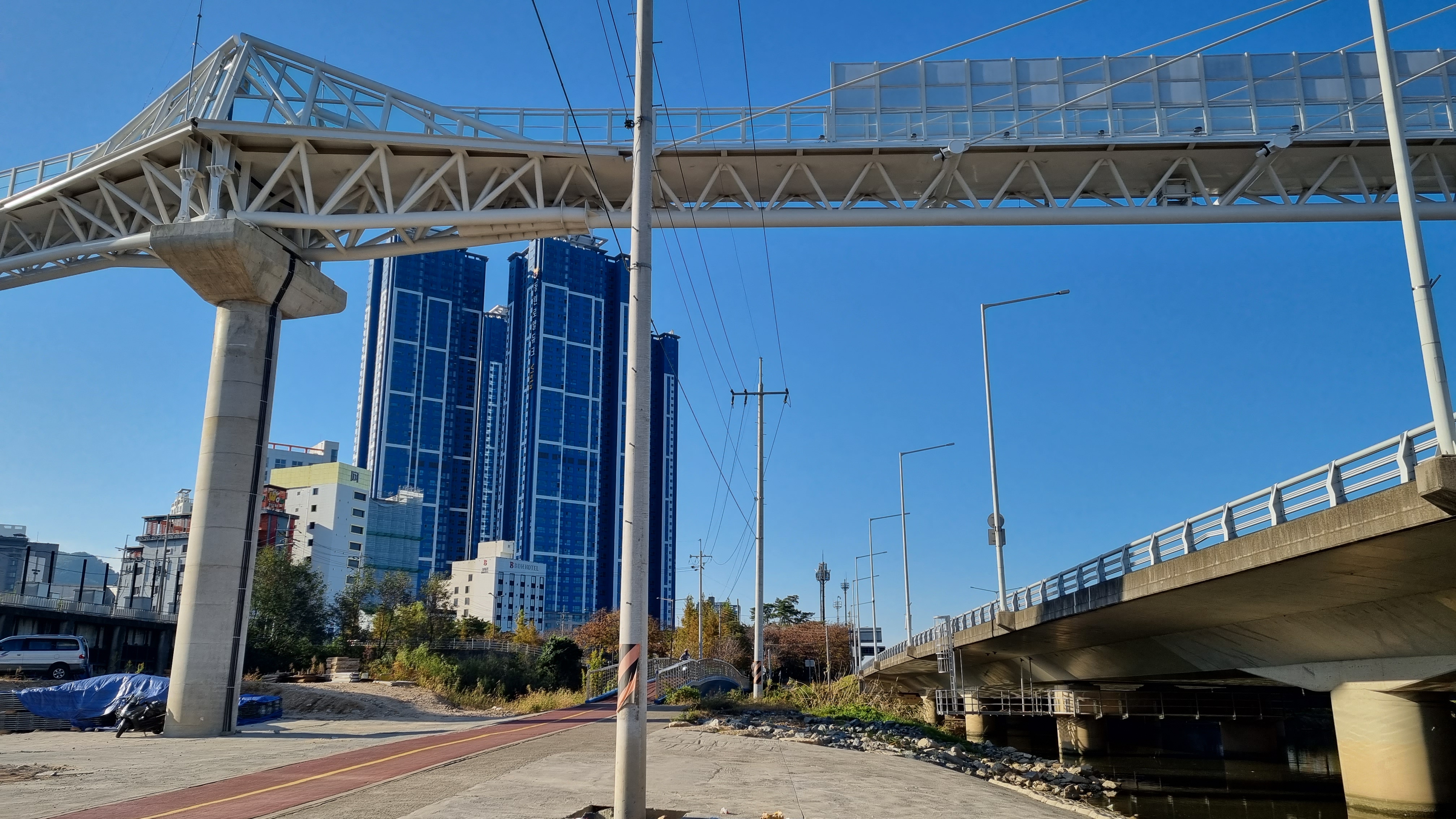
| This about the moment where I say to myself, "Okay, I'm in Busan now." |
 |
| Do you see the morning train? |
 |
| The final 22K. |
 |
| Bukgu/북구 = North District (or North Ward) |
 |
| Gukto Jongju |
 |
| Ubiquitous exercise area for the old people... we should do more of this in the States, frankly. |
 |
| down to 20K |
 |
| taking advantage of the barefoot path |


I should take a moment to talk about the difference between the Four Rivers walk and the east-coast walk I'd done a couple years earlier. The final day of the east-coast walk had me starting by the East Sea, then walking inland through the city to the Nakdong River Estuary Barrage. It was a thoroughly unpleasant walk that left me with a bad taste in my mouth. The Busan I saw that day was over-urbanized and ugly, full of crosswalks and traffic lights and noise and way too many people. This was a completely different Busan from what I see whenever I do the Four Rivers path, and I much prefer this path. First, it's a fairly straight shot south from Yangsan to my destination. Second, there are fewer people out, even once we get past early morning and into midmorning and the afternoon. Third, it follows the river, which minimizes the amount of traffic I'm exposed to, so things are generally quiet and a bit "closer to nature," if you will. No matter how you cut it, the Four Rivers approach to the goal is a much nicer path—less crowded, more peaceful, more beautiful. Just look at the pics and see for yourself.


 |
| The "forbiddens" are: water sports, tents, and cooking. |
 |
| Something's being built or rebuilt. |
 |
| "Danger: deck damage. No vehicles." |
 |
| Blue skies. Shaping up to be a gorgeous day. |
 |
| Park golf, my nemesis, has followed me all the way down to Busan. |
 |
| 대동화명대교/Daedong Hwamyeong Bridge (could mean "Great East Brilliant Bloom Bridge") |
 |
| As grouchy as I am about park golf, I remain thankful for this route. |
 |
| Orwellian police state |
 |
| Hwamyeong Ecological Park |
 |
| Looks almost like a golf course, but this field wasn't being used for anything when I passed it. |
 |
| another one of those one-lone-tree scenarios |
 |
| a map of the eco park |
 |
| 구포낙동강교/Gupo Nakdong River Bridge |
 |
| human assholes! |
 |
| The path along the Nakdong to Andong Dam is, in total, about 385 kilometers, I think. |
 |
| This footbridge feels new. |
 |
| I may have to go up there and take a stroll someday. |
 |
| Even on the final day, we're not done with abandoned gloves. |
 |
| a bit cooler in the buildings' shadow |
 |
| 13 km to go |
 |
| 구포대교/Gupo Bridge |
 |
| We're coming up on what may be my favorite stretch, despite there being traffic on both sides of the path. |
 |
| ...and here we are. |
 |
| 강서낙동강대교/West-of-the-River Nakdong River Bridge |
 |
| Normally, there's a path I'd follow here, but today, it's blocked by construction. So down we go. |
 |
| The river is still off to the right, but I'm down off the berm on a parallel path. |
 |
| I got bored and climbed back to the top of the berm. Nothing stopped me, and I could see the construction for myself. |
 |
| the final 10K! |
 |
| bent, twisted bench |
 |
yellow sign, arcing text: should danger arise, dial 112
yellow sign, above the 3: ecological park
purple/lilac sign: Point 961, Nakdong River bike path |
 |
| high-pressure gas line marked off by the sign |
 |
| We go right. |
 |
| Just looking. I'm still following the river. |
 |
| An old man pushes his wife along the path. |
 |
| a camellia, also the name of the buffet I'll be going to later |
 |
| also a camellia, I think |
 |
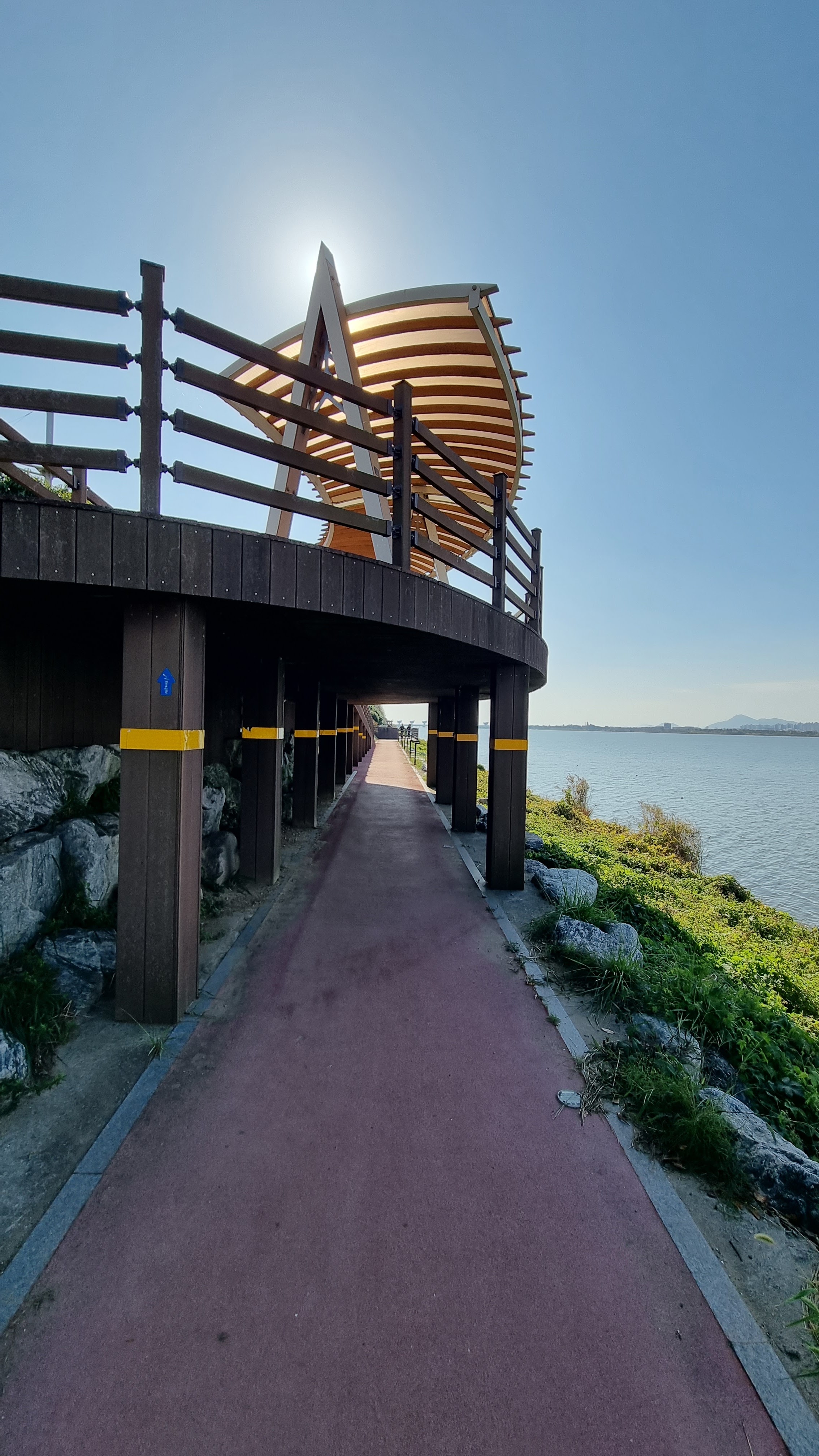
| An observation deck that I never use. |
 |
| Samnak Ecological Park Administrative Office |
 |
| a map of Samnak Eco Park |
 |
| 8K to go |
 |
| a lot of the urban nonsense that I've been avoiding by staying by the water |
 |
| Maybe it says, "Exciting Sasang!" I don't know. |
 |
| I'm not with this traffic for long. |
 |
| This tree-lined segment is coming to an end. It started at the 12K mark and will end at the 5K mark. |
 |
| 서부산낙동강대교/West Busan Nakdong River Bridge |
 |
| I'd love for these to be pot plants. A man can dream. |
 |
| I've seen the names Alaria, Cephalaria, and Fatsia applied to this plant. |
 |
| cool logo |
 |
| Just a little bit more to go, then... |
 |
| ...it all opens up. |
 |
서부산낙동강교/ㅈWest Busan Nakdong River Bridge (smaller)
Trivia: large bridges are often called 대교/daegyo, literally "big bridge." This bridge, however, is merely a 교 (gyo, bridge). With so many similarly named bridges around here, you have to be careful when navigating. Further trivia: even though 교/gyo in this context means "bridge," it's a "bound particle," i.e., it never appears alone. If you tell someone about "that bridge over there," you don't use the word 교/gyo. The stand-alone, pure-Korean word to use is 다리/dari, which means bridge. You can talk about "that dari over there."
|
 |
| And this is the end of the tree-lined path. A good 7 kilometers of this. Nice. |
 |
| No more tree coverage from now on. There will be trees, but not nearly as much shade. |
 |
| Gukto Jongju bike path: left |
 |
| Cross the street and turn left. |
 |
| Trees are farther apart here. Not as much shade. |
 |
| digital zoom of the Nakdong River Estuary Barrage, which represents the final kilometer of the walk |
 |
| seen at 1X magnification |
 |
| All this scrub is left undeveloped because this riverside land can flood. |
 |
| I've chosen to drop below street level. Slightly quieter, but I can no longer see the distance markers clearly. |
 |
| Is this my final spider pic for the whole trip? |
 |
| ...unless they peek out high enough. (I think I missed the 3K marker.) |
 |
| Plane on final approach to Busan's international airport, using the river as a guide. |
 |
| If I'm not mistaken, these burdz with the tiny bills are loons. |
 |
| Yup, I missed the 3K marker. 2K to go, so 1K to the barrage, then 1K across the barrage. |
 |
| Lord of the Rings-style shwimteo |
 |
| The end is starting to feel real. Mixed feelings of happiness, accomplishment, and sadness. |
 |
| the Pyracantha we'd encountered a while back |
 |
| Just right of center, across the river, you can see the angular tower that marks the very end of this trek. |
 |
| a closer look |
 |
| about to hit that final stretch |
 |
| Enjoy your day! |
 |
| We're on the barrage now and here's the lion (not Lion's Club, thank God). |
 |
| At the beginning of this post, I explained this text. |
 |
| final kilometer |
 |
| Holding the phone camera over the railing always makes me feel as if I'm going to drop it. |
 |
| This is a nifty shot. I should paint out that thin, curved line, though. |
 |
| the final 100 meters! |
 |
| ...and here we are. |
 |
| Celebrating fish greet you. |
 |
the official finish
"Four Rivers Gukto Jongju Nakdong River Bike Path Finishing Point (Barrage)" |
Because of my shortcuts, I'd walked less than the official 633 km distance, but because of the extra walking I'd done on my "off" days, I was at around 630 km.
 |
| Koreans love their abstract sculpture. |
 |
top row: 복지의 새 기지 (foundation of happiness)
bottom row: 낙동강 하굿둑 Nakdong River Estuary Barrage
So this commemorative tower is even more celebratory than I'd thought! |
 |
| Statue for national unification... something I no longer wish for. |
 |
| The absolutely final cert center for the Four Rivers path. |
 |
| That stone marking the end of the path also marks the beginning, just like that arch in Incheon. |
 |
| repose |
No time for sitting on my laurels, though: the day isn't done! I walk out of the park and down to the bridge. I cross the bridge, as I've done every time before, to catch a cab, this time to the Westin Joseon Hotel to try to check in to a room and confirm my reservation at the Camellia.
 |
| the footbridge just outside of the park, leading to where I usually catch a taxi |
 |
| the view from a bar in the Westin |
A lot has happened between the shot above and the shot below. I got rejected from the Westin (several floors under construction, so no single rooms available), but my Camellia reservations were intact. I met my buddy Neil after a bit of a mixup as to where to meet, then we headed to the buffet to gorge ourselves on expensive hotel food. Everything was delicious. And worth it.
 |
| Camellia buffet, Round 1: beef abalone, mashed taters, pasta |
 |
| Camellia buffet, Round 3-ish |
 |
| Camellia buffet, dessert round |
All in all, a very satisfying day.


Mission accomplished! Well done (again). I have always enjoyed spending time in Busan, and your photos are a good reminder of why. It was nice sharing the adventure from a distance, and I look forward to coming along again next year.
ReplyDeleteThanks, John, for following the adventure.
DeleteCongrats, dude. I missed a bit along the way when I was at my conference in the States; I'll have to catch up on that bit later.
ReplyDeleteThanks and welcome back. I enjoyed your write-up of the trip.
DeleteMan, that's a lot of photos. Some damn good shots of the things you saw along the way. Good job!
ReplyDeleteOnce I add captions and enlarge the pics, I hope that the photos will flesh out the story of the hike a bit more. When I was slapping up my ten pics a day during the walk, they weren't always the ten best pics. I'd like to think I held some stuff back in reserve. Example: on the day I arrived at Suanbo, I saw some fucked-up-looking larvae that were monstrously huge (here and here). Those pics might not give you a sense of scale, but each curled-up larva was fully two inches across.
Delete