Only three more walking days left, then it's back to the urban world and back to the grind. I'm at the Hwangtobang Motel in Hanam-eup, which turns out to be part of Miryang City. I'm walking to eastern Miryang tomorrow; it's only a 19K trek, which ought to be a snap after today's 30K walk.
In truth, today's walk was great. It started with no fog and was warmer than I expected. My buddy Tom sent me an early Kakao voice message complaining about how cold it was in Seoul (4°C, or 39°F, this morning), whereas I was enjoying an 11°C/52°F morning. I began the morning wearing my ski mask, but I took it off within minutes. The day got even more beautiful as the sun rose and warmed the earth, and it was hard not to feel cheerful. Maybe partly because of my meds, I felt great after resting in Namji an extra day—recharged, rejuvenated, re-energized. Foot pain wasn't an issue until much, much later in the day, and when it came, it wasn't major.
I had aimed to leave at exactly 5 a.m., but I got waylaid by the friendly cat, who had disappeared the previous day (good thing I'd forgotten to buy it food) but had rematerialized this morning. The cat met me at the Heitz motel's entrance, and I spent some time giving it scritches before I finally forced myself to leave before I started thinking about adopting the animal.
It was about as pleasant a day for a long walk as you could ask for, and I think the weather forecast for the rest of my trek is all clear: no more rain on the horizon except for Friday, but I'll be resting in Yangsan on that day, so it doesn't matter. Here's hoping the forecast doesn't change from now to then. Or if it does, may it change only for the better.
There's one more mean hill on this walk, and I didn't encounter it today. I think I hit it tomorrow. Tomorrow does start off cold, by the way, so I might have to use my new gloves after all. Excellent.
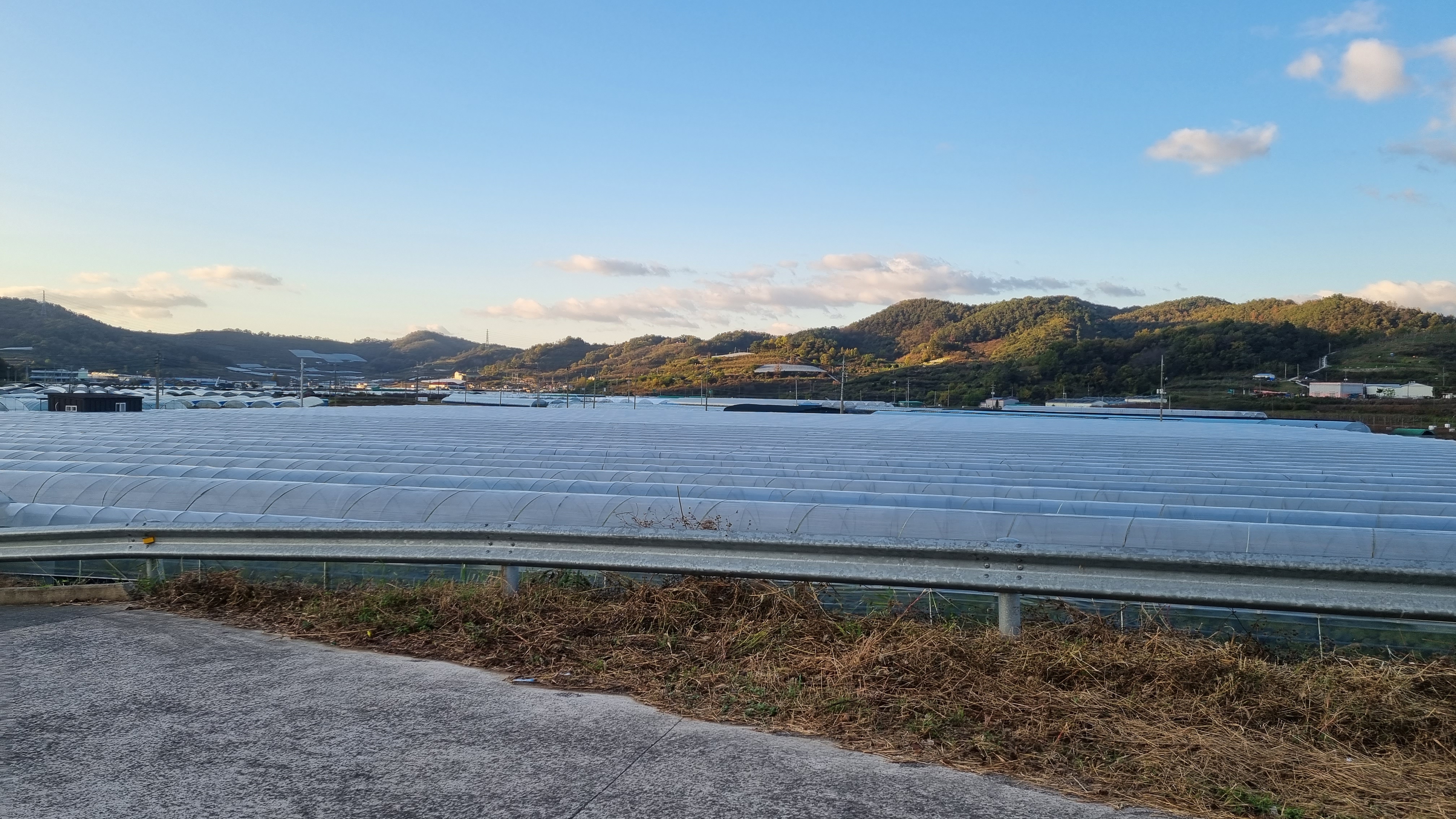
Since I've done the Four Rivers path three times before, I often find myself trying to pre-visualize what I'll encounter during the segment I'm doing. Today, I had a very clear recollection of the final few kilometers, but I'd forgotten about most of the walk before that part, so it was fun to pass through familiar territory and be reminded of past walks, including what I think is the last dam on the walk except for the estuary barrage at the very end. I did goof and end up off the official path for a bit today, but I was on a boardwalk that ran parallel to the official path, so there wasn't any big problem.
One humorous thing to occur today is what I think of as a "double sunrise." Not like the two suns of Tatooine in the Star Wars films, rising simultaneously, but one "sunrise" after another. In a river valley, there's no hope of seeing a sunrise the way you do at the ocean. In a valley, your "horizon" is the surrounding mountains, and by the time the sun peeks over the crest of a mountain range, it's already way after sunrise, and the sky is thoroughly lit. But if you're walking toward a mountain when the sun peeks over it, then you keep walking toward the mountain so that the mountain gets bigger in your field of view and hides the sun, you can experience a "second sunrise" when you veer to the side, and the sun peeks out once more. I saw that today and took photos.
I passed a ton of persimmon orchards, too, and with so many fallen persimmons begging to be eaten, I risked my luck once again and grabbed a nice-looking fruit off the ground. Fully expecting the sticky, bitter taste and feel of an unripe persimmon, I was pleasantly surprised to discover that I had yet again hit the jackpot. And this time, I remembered to take a picture.
So today's walk was without incident and almost devoid of human interaction except for when I got to my motel and talked with the lady managing the place. This did indeed turn out to be the same motel I'd used three years earlier. My room is W50,000 a night, which is pretty ridiculous given how run-down everything is. I wonder if I got charged a foreigner's tax. A room like this shouldn't cost more than W30,000, frankly, but the place has WiFi (surprise!) and a decent bathroom. Also, in the tradition of old-school yeogwans, my room has a million nails sticking out of the walls, which is great for hanging all my stuff. Nails are ugly, but for transients like me, they're practical.
I've got the fan and A/C going. I'll turn the A/C off tonight since it's supposed to get cold. Aside from that, I plan to launder my underwear and socks, take a shower, re-dress my injured toe, and spend the rest of the evening watching YouTube. I can afford to wake up at 5 tomorrow morning since my walk is only 19K to eastern Miryang, which means I can stay up until 11 tonight if I want. This is something I take for granted in my normal life: I'm usually a night owl who stays up until almost sunrise before finally bedding down and getting up just before lunch. But on these walks, I'm a different person, so bedding down at 11, not 10, is special.
Info and images:
 |
| Crossed the river four times. |
 |
| about 3.6 kph today—better than usual |
 |
| kitty says bye |
 |
| a well-lit path (and no fog) |
 |
| yet another family plot |
 |
| flowerz (chrysanthemums?) |
 |
| first "sunrise" |
 |
| no vampires here |
 |
| second "sunrise" |
 |
| lucky persimmon; this is the kind you eat like a crunchy apple |
 |
| Changnyeong Haman Dam—the last dam until the very end |
 |
| curvy road, mountains, and the Nakdong |
ADDENDUM: I forgot to mention that it happened again: I got the key to Room 403 at today's motel; the front-desk lady said the room was already open. I took the elevator up, went to my room, opened the door... and a startled grandmother leaped up from the room's bed and began babbling about not having a room. I politely asked her whether she was a staffer; she said no (but I think she's the housekeeping staff), then added something I didn't understand. I apologized for disturbing her, but I did have a key for this room. She apologized in turn, then left. I think motel managers need to keep better track of who's in what room, and when.
PHOTO ESSAY
 |
| geared up and ready to go |
 |
| It's been real, kitteh. |
 |
| So long. |
 |
| moon and Venus (low, close to a building) |
 |
| approaching the edge of town |
 |
| the roundabout before the bridge |
 |
| about to cross the river |
 |
| Here we go. |
 |
| This is the 남지대교/Namji Bridge. |
 |
| crossing the Nakdong |
 |
| off-ramp |
 |
| about to U-turn |
 |
| 창녕낙동강대교/Changnyeong Nakdong River Bridge |
 |
| 97 km to final goal |
 |
| Gukto Jongju |
 |
| dawn's early light |
 |
| another mystery chair by a tree |
 |
낙동대교/Nakdong Bridge coming up (near the edge of Busan is the similarly named 낙동강대교, or Nakdong River Bridge—you'll see soon enough) |
 |
| 95K to goal, 290K back to Andong Dam |
 |
| Chilbuk-myeon (Chilbuk Village) |
 |
| Sorang-gyo (Sorang Bridge) |
 |
| looking eastward |
 |
| the huddled pumpkins |
 |
| family plot |
 |
| chrysanthemum |
 |
| on the right track |
 |
| more chryssies |
 |
| old-school K-architecture (with slapdash additions) |
 |
| 94 km to final goal |
 |
| The sun was up and out, but as I walk toward the mountain's shadow, I get a second "sunrise." |
 |
| Gukto Jongju |
 |
| Changnyeong-haman Dam cert center, 1.5 km |
 |
| Milpo Bridge |
 |
| a profusion of persimmons |
 |
| lucky enough to get a ripe one |
 |
| Koreans won't be happy to know this is a "Japanese morning glory" in English. |
 |
| And there's the dam. |
 |
| more of those spinning aerators |
 |
| cert center, 100 m ahead |
 |
| Almost every dam has an admin building next to it. |
I went into the admin building, despite the early hour, in the hope that the convenience store would be open, and I'd be able to get drinks and snacks. The convenience store was open, but there was no one manning the cash register. I picked up the things I wanted, then waited. It took a few minutes, but a lady came running up eventually, and she rang up my items. After that, it was up to the rooftop to chill a bit.
Door leading to the rooftop:
 |
| sign: "Careful of the step" |
 |
| With an appearance by Danger Man! |
 |
| Can you tell which way is east? |
 |
| the view looking back behnd the admin building |
 |
| another angle |
 |
| the shwimteo where I sat |
 |
| Those desperate-looking handprints... like in a horror movie. |
 |
| going down and out, about to cross the dam |
 |
| the cert center |
 |
| Changnyeon-haman Dam |
 |
| crossing |
 |
| anti-suicide message: "When you can't see the hope in living..." |
 |
| turning right |
 |
| Gukto Jongju bike path (to Busan) |
 |
| the local bus stop for this dam |
 |
| We're going to curve right, then left. |
 |
| 90 km to final goal, the ground says |
 |
| 85 km to final goal, the marker says |
 |
| 89 km to final goal, the ground now says (see why you should never trust these indications?) |
My theory is that the various markers are made by different groups of people, each with its own way of measuring distances. So you can't trust the distances shown except as, maybe, a very rough estimate.
 |
| Huh. I now see that this was a very nice shot. |
 |
| 88.2 km to final goal. We're doing decimals now. |
 |
| On the ground, it says, "Sharp curve." |
 |
| like the tomb of a pharaoh |
 |
| Another fine shot. Ooh, this could be a new desktop wallpaper. |
 |
| The sign warns about not entering the grounds (near the river, I guess) guess flooding here can lead to loss of life. |
 |
| Yeah, this would be a suck-ass place to be if there were a flood. |
 |
| 86 km to final goal, 299 km back to Andong Dam |
 |
| short hill up ahead... no biggie |
 |
| another mystery shrine |
 |
| These appear periodically. I agine they serve some sort of function. Anti-landslide? |
 |
| Pulled back to a 0.5X zoom for the wide-shot closeup... if that makes any sense. |
 |
| looking back |
 |
| looking ahead |
 |
| arfer |
 |
| There's a convenience store around here, but I didn't feel the need to visit it. |
 |
| That's my "I just bypassed a convenience store! Impressed?" look. |
 |
| little neighborhood |
 |
| This resource says, "Seed cones of the dawn redwood, Metasequoia glyptostroboides, the fabled deciduous conifer from China." The tree is considered a living fossil. The seed looks a lot like a giant-sequoia seed, but it's not. There are no giant sequoias in Korea as far as I know. |
 |
| Technically, I'm supposed to go left and up, but Naver shows the two paths run parallel, so... |
 |
| ...I break right. |
 |
| death in an uncaring world |
 |
| Da boid convention. |
 |
| More or less literally: "In the event of strong snow or flood, this bike route is blocked." |
This may be a big reason why riverfront property can be a dicey thing. Rivers can and do flood with some frequency, so if you build your house too close to the water, things could turn bad very quickly.
 |
| Turn left! Turn left, already! |
 |
| I have to turn right onto a shoulderless road for bit, but there's very little traffic. |
 |
| right across the bridge |
 |
| The green sign says I'm entering Changweon City. |
 |
| Bonpo Bridge |
 |
| Welcome! We are the Lion's Club, and we are everywhere! |
 |
| toward Miryang and Su-san Bridge |
 |
| Bonpo Waterside Ecological Park |
 |
| digital zoom of Boaty McBoatface |
 |
| 77.2 km to final goal |
 |
| the final 7K stretch for the day |
 |
| wild persimmons |
 |
| looks like a camel cricket that's seen some war (could be a wart-biter cricket) |
 |
| The town of Hanam-eup is coming up. It's where I'm stopping for the day. |
 |
| another double sign: Four Rivers + Nakdong River bike path |
 |
| Blower teams are out... blowing. |
 |
| "Illegal cultivation, sharecropping, and littering forbidden." |
 |
| "Nakdong River bike path" |
 |
| Su-san Bridge |
 |
| Damn. Construction. Gotta cross. |
 |
| They're renovating the guardrails. |
 |
| On the other side now. |
 |
| almost in town |
 |
| breaking right |
 |
| It says Miryang City, which is the larger city, but this is the town of Hanam. |
You may recall that, just to the east of Seoul, there's a city (not town) called Hanam.
 |
| more chryssies |
 |
| yellow ones |
Maybe my phone battery was running low or something, but I skipped a segment of the walk—the last few hundred meters to my motel, the Hwangtobang. W50,000 for not much, although the water supply is a plus. I drink a lot when I walk all day, but there was enough in the tank that I wouldn't be emptying it anytime soon.
 |
| Bug sprays... but I didn't have any bug trouble. |
 |
| A 0.5X zoom to give you a wide angle of the humble room. Look at the folding table. Cute. |
 |
| facing toward the exit |
 |
| resentful cat hates foreigners |
 |
| The red-letter sign at the top is a for a martial art called Guksul-weon (국술원). |
 |
| my tacky motel |
I went in search of food. There's a restaurant I've been to twice before. Here:
 |
| Dalma-daesa (Bodhidharma) calendar |
 |
| I got the kalguksu and the bibimbap. |
 |
| bibimbap |
 |
| kalguksu (knife-cut noodles) |
 |
| meager banchan (sides) |
 |
| soup on the side |
It was a tiring day.


My favorites today were "a well-lit path" and the second sunrise shot.
ReplyDeleteIt does sound like the best of all possible worlds kind of day for hiking. Hopefully, it stays that way for the remainder of your journey.
You are so unlucky when it comes to finding strangers in your room. Why can't it be a cute girl like the one at the Chinese restaurant, lying naked on the bed and smiling invitingly as you enter. How's that for a double entendre?
By the way, that last remaining mean hill has a pedestrian tunnel you can take to avoid it. Assuming it's the same one I'm thinking of.
ReplyDeleteI think the tunnel you're talking about is called "Masa-Masa" (sounds vaguely racist to my American ear) since that is the 마사 region. I've never been in it, and I never formed the connection with hill-avoidance. Ethical dilemma: would avoiding that hill, which I've gone up every time I've come this way, be a cop-out? I avoid other hills, like the monster next to Mushim-sa, which I haven't been back to since 2017. It was that traumatic.
DeleteIn other news: I roughly measured the length of today's hill: it's a bit over 800 meters.
I saw that famous tree, too. Will talk about that in today's blog post.
Sorry. I have a photo showing a sign that says "Masa-Masa" in Roman letters, but in Korean, it says "마사 카페" and "마사 터널." Near as I can figure, "Masa-Masa" refers to... nothing.
ReplyDelete