Whew.
It was a long, tiring day, and I'm happy to have WiFi out at my campsite. I'm not camping where I'd hoped: the original plan was to be under Sangpoong Bridge, but sometime over the previous three years, the bridge got fenced off. So I walked two kilometers farther down the path and found what I hope is an unobtrusive spot. I won't be here long: I plan to wake up at 3 tomorrow and be on my way by 4. I ate almost nothing yesterday and today, and that may have helped to get me down to the seventh hole in my belt.
Today was the final day on the Saejae path. After all those warnings I'd gotten in 2017 about how bad the Saejae would be, the fourth and final day of it has always proved anticlimactic. It's a day of long straightaways and big skies—an enjoyable walk, but almost totally flat. Not that that's a bad thing, but I had originally expected more. Experience has taught me that the worst hills are yet to come.
Tomorrow's walk takes me to the Nakdan Dam (낙단보). From my current campsite, it's a 26K walk that would've been 28K had I not walked an extra 2K today.
I'm pooped, and it's only 5:30. I'll leave you with some info and images. Meanwhile, I'm gonna rest and let my phone charge.
 |
| I walked 2K extra. |
 |
| I survived on water and one persimmon today. |
 |
| leaving San Gwa Gang Pension |
 |
| an illegal bridge crossing |
 |
| cosmos |
 |
| The tree stands alone. |
 |
| sunrise over a mountain |
 |
| the old-people sport known as "park golf" |
 |
| autumn in full |
 |
| the Yeong-gang, a tributary river that leads to the Nakdong |
 |
| official beginning of the Nakdong River path (for people doing the Four Rivers, I mean) |
The real beginning of the Nakdong River path is way east in Andong, a city and region known for its traditional nature. Andong Lake is not exactly the source of the Nakdong River, but it definitely supplies a lot of water volume. The lake exists because of the Andong Dam, which is the starting point for the Nakdong river trail. The path from Andong, through Sangju, then eventually down to Busan is its own Gukto Jongju (national end-to-end path), about 385 kilometers long, substantially shorter than the Four Rivers' 633 km. So from the endpoint of today's segment to the end of the whole trek, I'll be walking on a path with several names: the Nakdong River Gukto Jongju, and the Four Rivers Gukto Jongju.
 |
| God shed His grace on thee |
PHOTO ESSAY
 |
| leaving San Gwa Gang Pension |
 |
| Light pollution before 6 a.m. can be intense. |
 |
| shooting and archery ranges (see the icons) |
 |
| starry night with Orion |
 |
| ...and sometimes the light pollution gives way to darkness. |
 |
| most likely Venus |
 |
| Technically, I'm not supposed to cross here, but Naver is showing this as the route. |
 |
| "passage forbidden" |
 |
| passing anyway |
 |
| same signage on the other side |
 |
| a very prim and rectangular shwimteo |
 |
| A car is about to roll up. |
 |
| the lightening sky |
 |
| a place selling some kind of food product(s) |
 |
| slightly overgrown shwimteo |
 |
| The blue font says Gukto Jongju. We're on the right path. |
 |
| The presence of dirt indicates drainage problems, which I've encountered all along the path. |
 |
| I like this stretch. |
 |
| I think a dude may be up there exercising. Old people are active in the morning. |
 |
| cosmos |
 |
| Reminders of fall are everywhere. |
 |
Another "be careful of mountain fires" sign. The crosses indicate anti-landslide cables/anchors fed into the mountain to prevent avalanches. |
 |
| stone that looks like wood |
 |
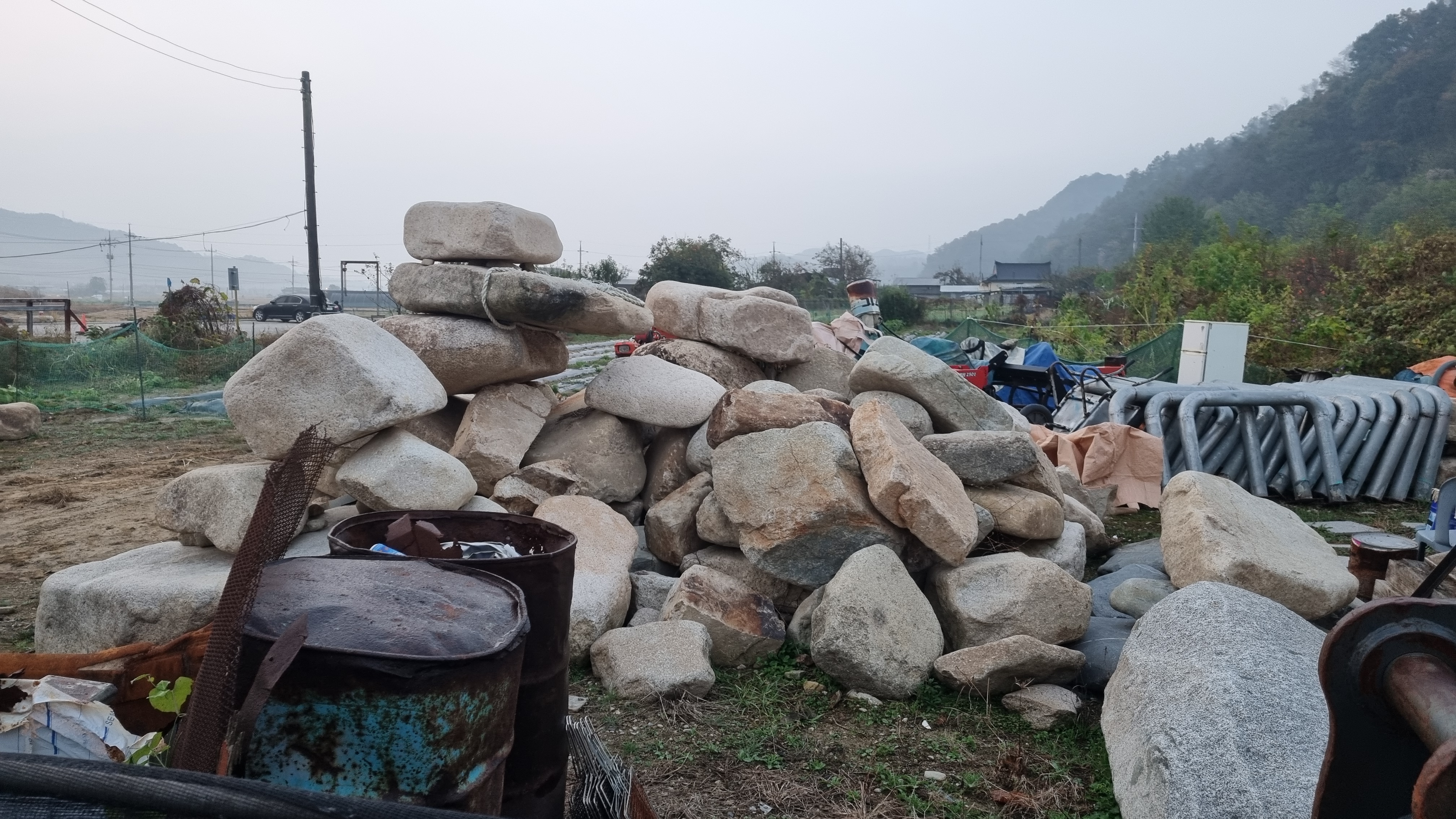
| Rocks are often used for landscaping. |
 |
| A place for a lot of people to both rest and exercise. |
 |
| strange house |
 |
| the lone, dignified tree |
 |
| arfers doing their duty |
 |
| running back and forth in frustration |
 |
| But here's a cool customer. |
 |
| A sign for the Saejae bike path. |
 |
| Arfer sings out his hello. |
 |
| Wouldn't be the Four Rivers path without an elegantly dead serpent. |
 |
| I'm pretty sure I took a piss around here somewhere. |
 |
| Hyeopdong Bridge |
 |
| I passed a few of these detours along this stretch. |
 |
| The sun peeks over a mountain. |
 |
| ubiquitous marshmallows |
 |
| a sign warning drivers to slow down for road construction |
 |
| It's early, so for the most part, it's just me on this road. Nice and quiet. |
 |
| park golf |
 |
| When I see civilization, my mind inevitably turns to snacks. |
 |
| farm-equipment repair place |
 |
| vehicle looks as though it should be on Mars |
 |
| a field of cosmos |
 |
| I take this to mean "dodge left," not "go to the farther intersection and turn left." When in doubt, follow the phone. |
 |
| the typical warning about not playing in the water |
 |
| Danger Guy shows us why it's dangerous. |
 |
| bicycle or wheelchair? |
 |
| I like this long-legged version of me. |
 |
| Is this a cairn? |
 |
| This looks to be a cairn. |
 |
| Persimmons come in different shapes. Some are heart-shaped; others are pumpkin-shaped. |
 |
| The sign says, "Mungyeong City Ground Golf Course, Entrance." Ground golf, not park golf. |
 |
| rock-climbing wall ahead |
 |
| Jeomchon Rotary Club |
 |
| climbing wall in all its glory |
 |
| Mungyeong International Climbing Center |
 |
| The trail goes thataway. |
 |
| more old-people spoor |
 |
| One of the "Let's live right!" rocks. |
 |
| old-school shwimteo with textured hula hoop |
 |
| another creek digger |
 |
| definitely fall |
 |
| It's a really nice park I'm walking through. |
 |
| "Through steady walking exercise to escaping obesity!" These signs usually recommend super-intense walking. |
 |
| I see sandworms. |
 |
| people doing their thing |
 |
| Sort your trash. |
 |
| Yeong-shin Forest |
 |
| The Chinese character in black at the corner of the shwimteo says, bok/happiness or good fortune. |
 |
| all our ducks in a row |
 |
| No playing in the water or fishing; this place by the "sluice gate" is a location for frequent accidents. |
 |
| the sluice gate, I think |
 |
| But the burdz don't care. |
 |
| Neither does the woman by the caution sign. |
 |
| Hope Rest Area (read columns right to left) |
 |
| the dignified restroom |
 |
| dodge right |
 |
| leaf print |
 |
| Maybe Harrison Ford is hiding somewhere. He's a pilot. |
 |
| abandoned building that used to be for supervising the environment |
 |
| animal assholes, probably a cat in this case |
 |
| Why is the sign up there all of a sudden? |
For whatever reason, my path is no longer my path but some parallel path above me.
 |
| An opportunity to move over presents itself. |
 |
| the one bizarrely yellow tree |
 |
| Mungyeong City Sewerage Office |
 |
| Again: Mungyeong City Sewerage Office |
 |
| a recent tire splat: still moist |
 |
| Now entering Sangju: "The Bicycle City. Be welcome as you visit." |
 |
| Mungyeong City, meanwhile, bids you goodbye. |
 |
| peloton! |
 |
| I remember seeing a lot of these tilted ramps in Jeju. |
 |
| The double sign (Four Rivers + Saejae) says we're on the right path. |
 |
| In Korean, these are all squashes, not pumpkins. |
 |
| another spot manned by an octopus |
 |
| heaven's lasers |
 |
| another "sluice gate" |
 |
| swingin' right yet again |
 |
| Ooh! Left for once! |
 |
| Strange: planting during the harvest season. Probably crop rotation. |
 |
| A sign for a resto makes me hungry. |
 |
| funky restroom in a pine-forest park |
 |
| I remember, years ago, that this spot was home to some free-running chickens. All eaten now? |
 |
| the Yeong River |
 |
| pollution is always with me, alas |
 |
| here's more |
 |
| and more |
 |
| Those old people never stay on their electric scooters for long. |
 |
| old, maybe abandoned bunker |
 |
| asters |
 |
| There's a really long turn right coming up. No avoiding it. Right, left, then left again. No one's built a short cut. |
 |
| confident trees |
 |
| This stretch always feels like a detour to me even though it's just part of the trail. |
 |
| men, women, trans (ha ha) |
 |
| up the ramp, left, and across the bridge |
 |
| Ihwaryeong is 43 km back the way I came. |
 |
I found a character that's close to the first Chinese character: 鳫/안, goose/swan. The second character, though, I found for sure. It's 凰/황, hwang/phoenix. But the first character has an extra stroke not shown in the character I found, so it's probably wrong. The final two syllables in the sign are Korean: 쉼터/shwimteo, i.e., a rest area. The verb to rest is 쉬다/shwida; the noun/gerund form is 쉼/shweem—rest. |
 |
| So I rested here a bit. |
 |
| I think that's a caterpillar cocoon. That, or a bunch of spider eggs. |
 |
| cig caught in web |
 |
| dead |
 |
| another spider, bouncing in the buffeting wind |
 |
| abandoned cow house |
 |
| more guardians |
 |
| pension in the distance—very tempting to stop and stay there |
 |
| Aerate that water! |
 |
| I took this shot right before they noticed me. |
 |
| Then they got up, and the arfing began. |
 |
| that one lazy dog who can't be bothered to get up |
 |
| classic rural life |
 |
| Sunlight Bicycle Air Injector (for bike tires) |
 |
| map of the Sangju interval of the Gukto Jongju |
 |
3rd from the bottom: Sangju Dam 19.1 km
Bottom: Nakdan Dam 36 km |
 |
| What's this bike's story? |
 |
| Anyone else see boobs? |
 |
| Final destination = 283 km away, or so this marker says. |
 |
| drying rice |
 |
| Another serpent gives up the ghost. |
 |
| Ah! The marker indicating we're officially at the Nakdong River, the "700 li" spot. |
 |
| The "700 li" stretch starts here. This corresponds to the "283 km" marker we'd seen earlier. |
 |
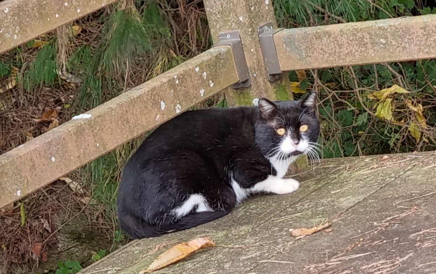
| Kitty can't decide whether to run. Fear versus laziness. |
 |
| At least one of these passing bikers was a foreigner. |
 |
| One of these was nicely edible. |
 |
| more death |
 |
| I guess this is better, as a catchphrase, than "Good Choongju." |
 |
| Eo Poong Dae, whatever that means |
 |
| signs for Andong Dam (left) and Sangpoong Bridge (ahead) |
 |
| keep going straight |
 |
| Wave all you want. I will not go left, little buddy. |
The photos seem to have skipped a few steps. In the pic below, I'm already leaving the Sangpoong Bridge behind because I'd discovered it had been fenced off sometime over the past few years, So I'm moving along the trail, following the river to what I hope will be a plausible campsite. I ended up walking an extra 2K.
 |
| nice afternoon if a bit windy |
 |
| This looked like a place to stop, but I ended up soldiering on. |
 |
| I finally stopped here. This turned out to be a bad choice. |
 |
| I didn't notice at the time, but there was a security camera overhead, and it was noisy. |
 |
| This feels like settling in, but... |
 |
| digital zoom of the moon (the camera can't show the moon's features) |
 |
| I'm now committed to this spot. Mistake. |


Loved the pictures today...the sunrise shot was fantastic l, and that tree was almost poetic. The shots from the trail were also outstanding. Such beautiful country.
ReplyDeleteI can't imagine fasting AND distance walking, but you do you, and I'll watch in envy. Hope the camping went well and you have a good day on trail. See you tomorrow! (vicariously)